
(if you're reading this from the future, the dashboards in these big posts tend to break pretty easily.
so an archive of the original images can be found on bluesky or mastodon.)
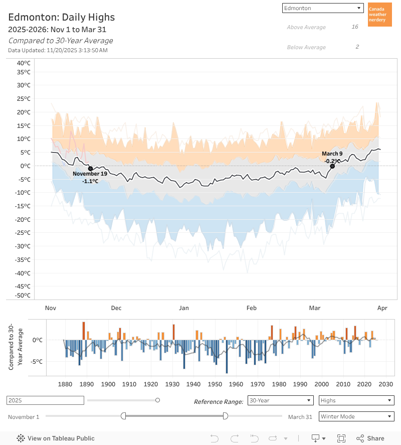 November 19th is the first day of the winter when our average High drops below Freezing.
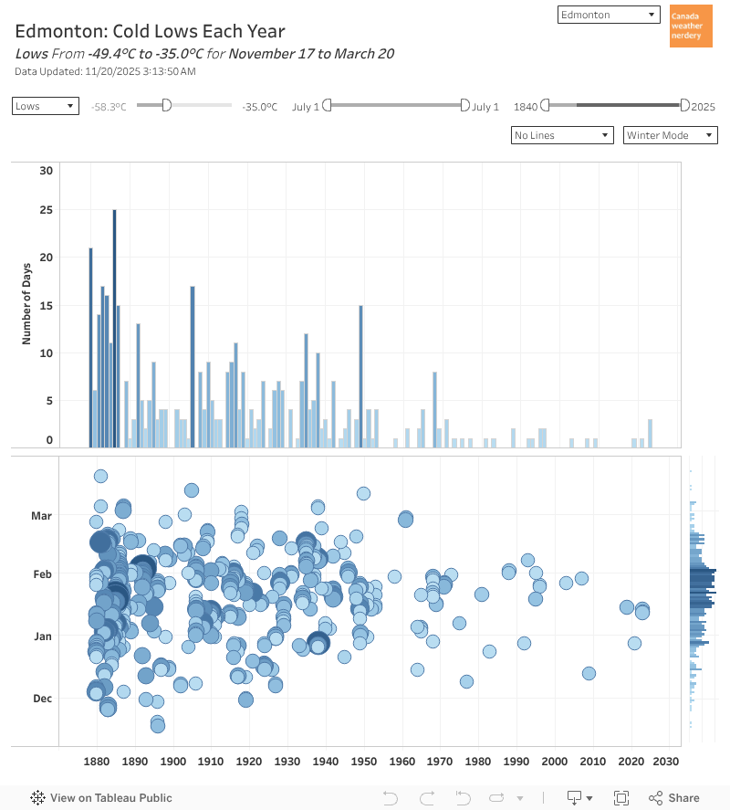 In those deepfreezes we average around 12 -25°C Lows (down from 25 historically), and 4 -30°C Lows (down from 12).
Deepfreezes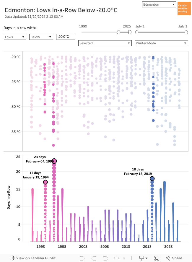 So in a winter we get around ~25 Lows of -20°C.
From 1998~2018 that usually meant a few weeklong deepfreezes each winter, plus some stragglers.
But 2019 gave us our longest deepfreeze in a generation. And since then we've had a bunch of other notable ones.
Last year we did a big look at our recent deepfreezes, and how they compare to history:
And it will stay down there until March 9th.
That's 110 days.
Ooof.
Average Highs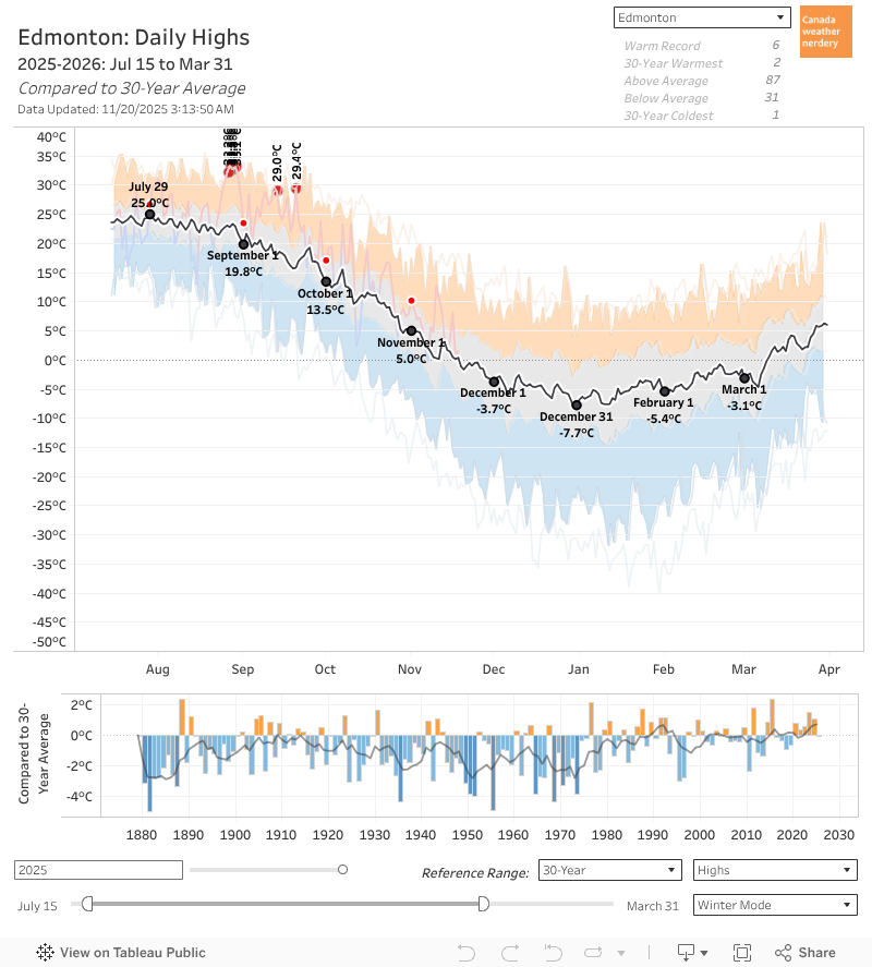 Our average High bottoms-out right around New Year's at -8°C, but that only lasts for around a week.
Average Highs
For most of December-February our average is more like -5°C.
Since July we've already dropped from 25°C to 0°C, so at this point we're already most of the way there.
Average Lows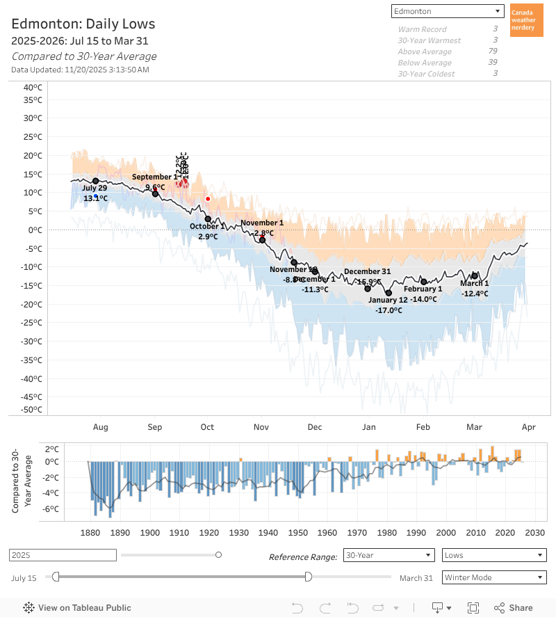 Our average Lows follow a similar path, although they bottom out in mid-January at -17°C, down from a peak of 13°C in July.
Average Lows
For most of December-February the average is around -14°C, and right now in the middle of November the average is still at around -9°C.
Calgary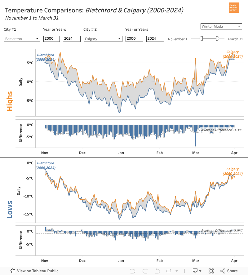 Compared to our friends down south, the overall shapes here look pretty similar, with average temperatures being fairly flat for most of December-February.
Calgary
But Edmonton's average winter Highs are typically around 5°C colder than Calgary's, and the Lows are 2°C colder.
Canada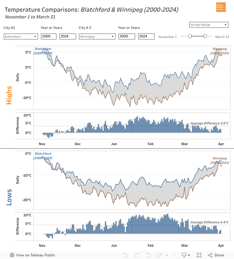 Other winter cities (Winnipeg, Ottawa, Montréal, and let's say Halifax) look a little different.
Canada
Edmonton's temperatures really flatten around New Year's, whereas it's more typical for temperatures to keep dropping until late-January.
Why is Edmonton (and Calgary) weird?
Warming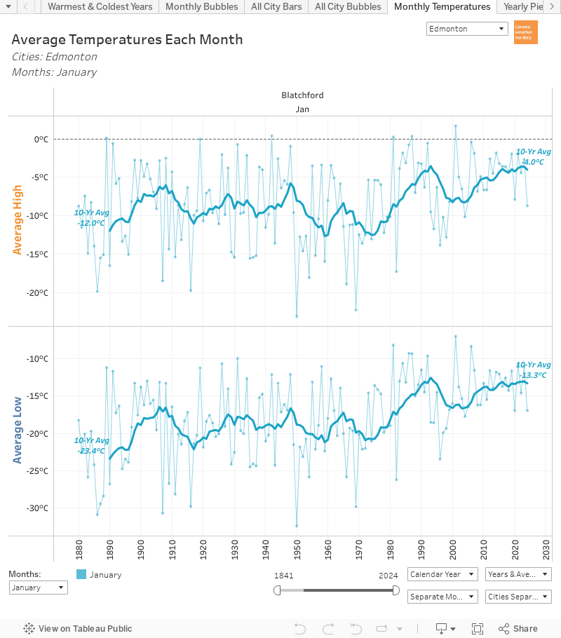 It will be hard to believe this once we're stuck in the middle of a deepfreeze, but Edmonton has seen phenomenal warming during January.
Warming
January's average temperatures are 8-10°C warmer than they were in the early 1970s.
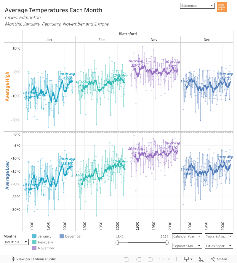 And that warming is really specific to January, with a bit in February.
Over 140+ years November's temperatures are fairly flat (slightly warmer Lows). And December has warmed up a bit more than November.
But January is up by 8~10°C, and February is up by 3~5°C.
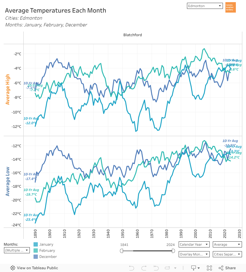 For most of recorded history, January was our coldest month by far.
But since 2010~2020 the average temperatures for December, January & February have all been really close.
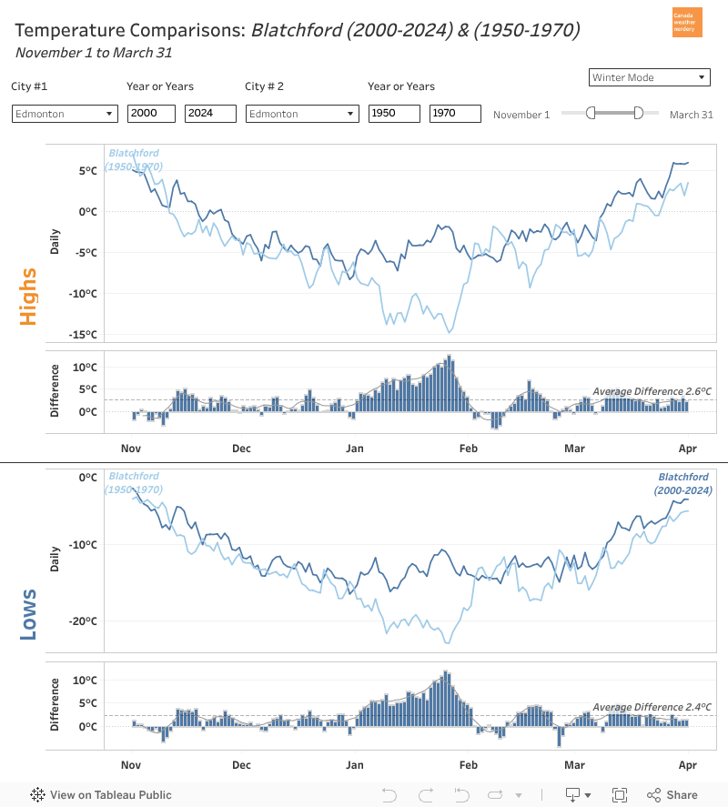 So if you compare the average temperatures for a modern winter to 1880-1900, or even to 1950-1970, there's now a giant chunk of extreme cold missing from January.
Once upon a time our temperatures continued dropping until late-January, but that's gone now.
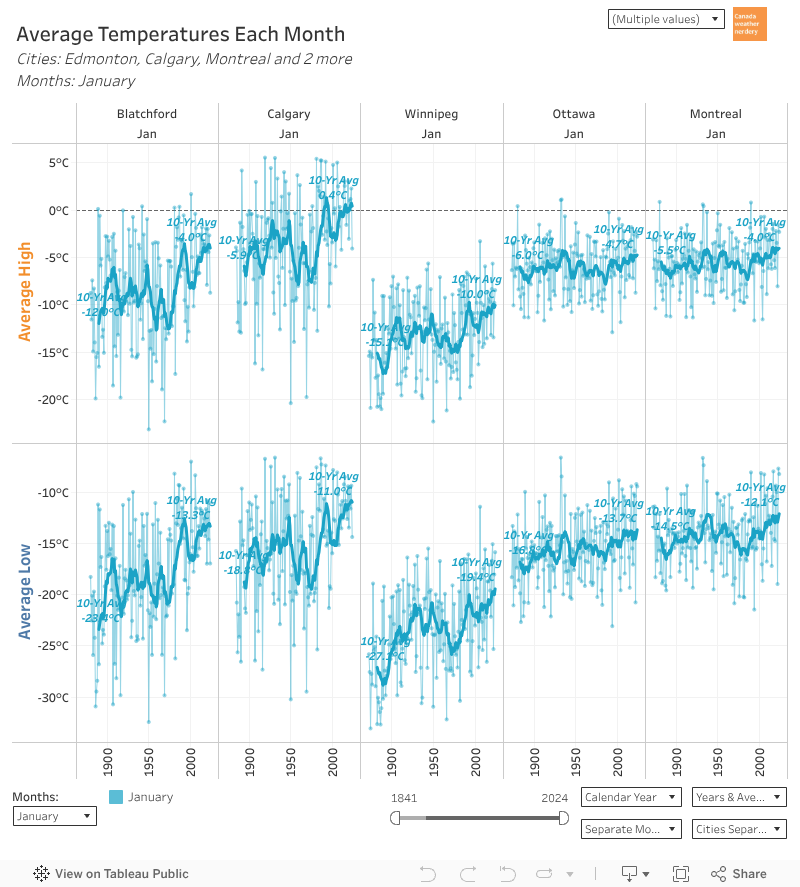 Other winter cities have also seen some January warming, but it's the largest by far in Edmonton & Calgary.
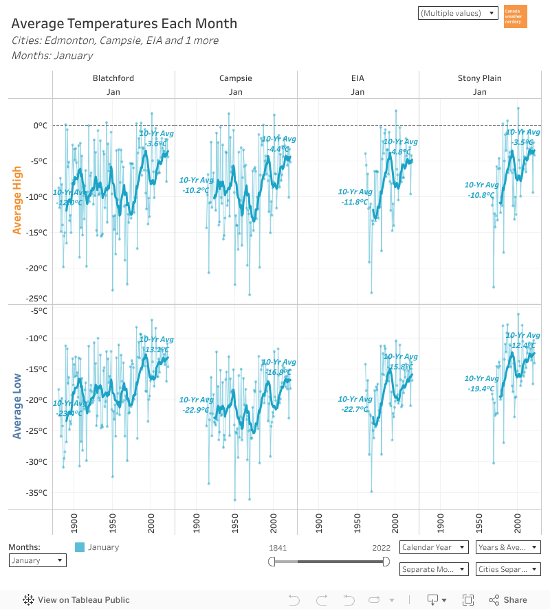 And the outlying stations around Edmonton have also seen big January jumps, even if their histories are shorter.
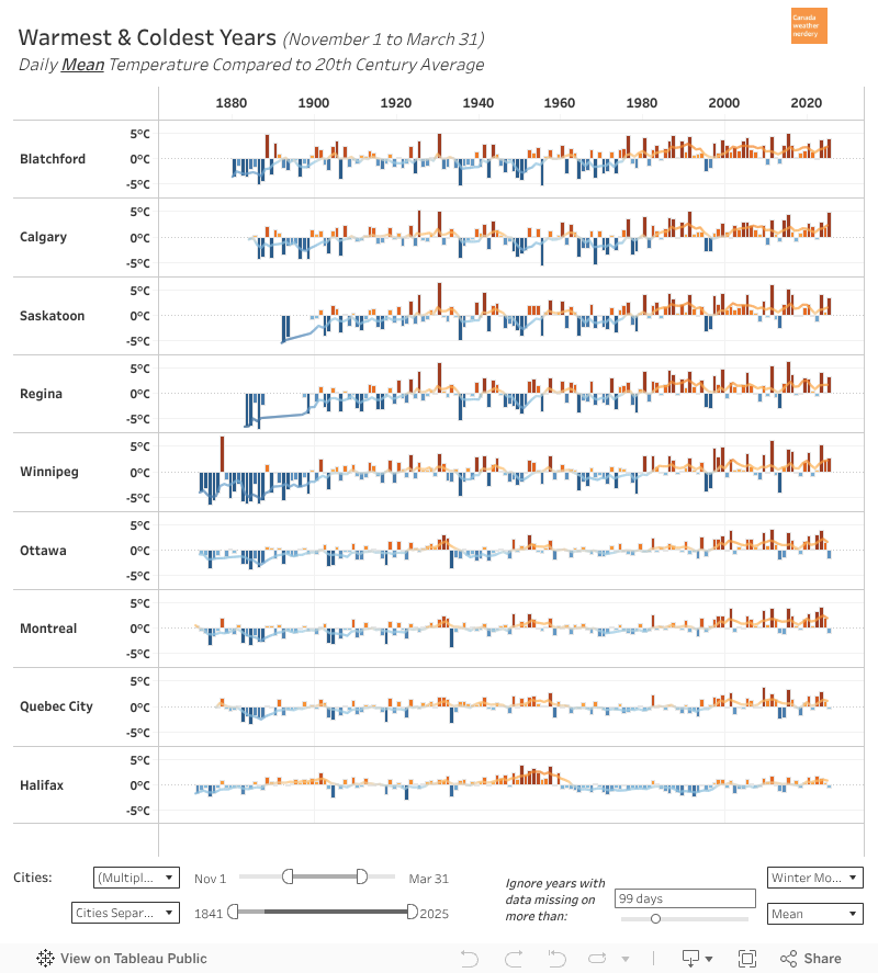 For a full historic perspective, this is how temperatures for each November-March compare to the 20th century average.
Since around 1980 most winters have been above average, sometimes by 4 or 5°C.
On the prairies the few big exceptions were 1995, 1996, 2010 & 2013.
Extreme Cold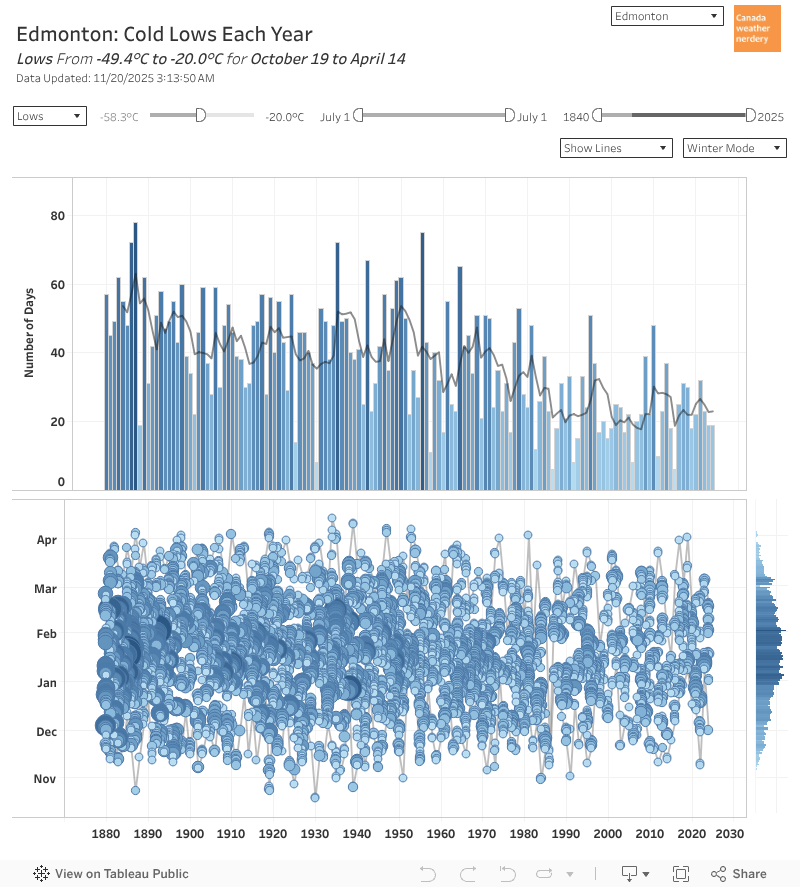 In a typical winter we average around 25 Lows of -20°C. So not quite a month of deepfreeze, typically spread somewhere between mid-November and mid-March.
Extreme Cold
That's down from 40-50 days historically, although recently 2010-2011 got to 48 of them, and 1995-1996 got to 52.
-35°C is pretty uncommon nowadays (we went from 2019 to 2020 without getting any), but then we got there in 2020, 2021, and January 2024 had 3 of them.
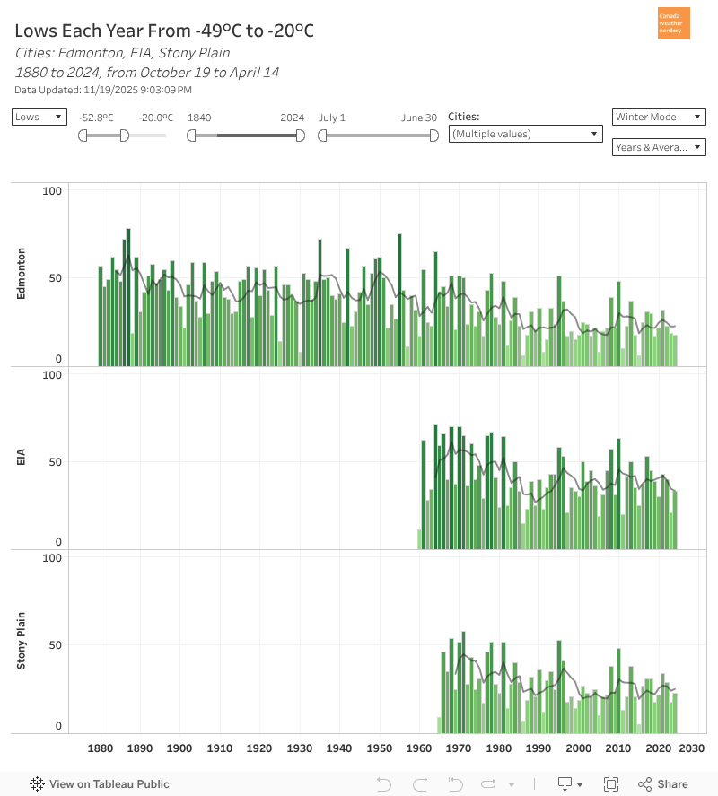 Our airport and the city are not the same.
The airport is very cold, even compared to other outlying stations.
Edmonton & Stony Plain average ~25 -20°C Lows, while the airport is around 40.
For -30°C Lows it's ~4 compared to 12.
So, don't live at the airport.
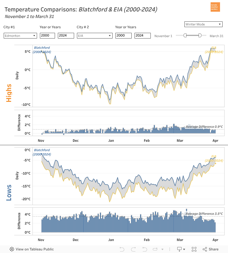 The airport's average winter Lows are 3.5°C colder than the City and Stony Plain, and almost 2°C colder that Villeneuve.
Making a trip to the airport is in some ways like making a trip to Winnipeg.
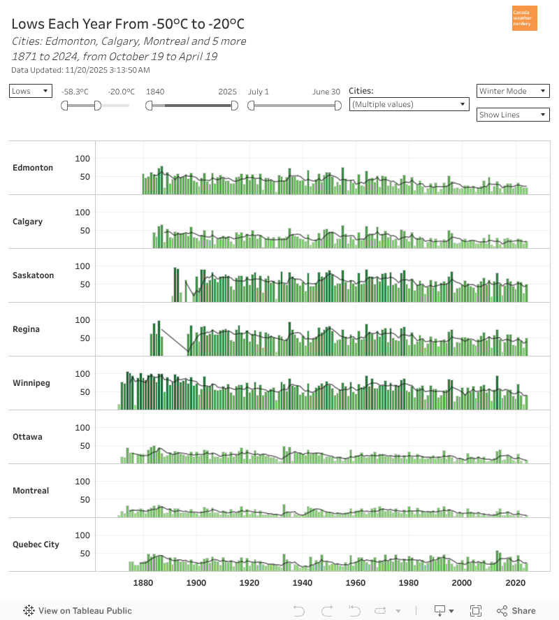 Speaking of Winnipeg...
For -20°C Lows:
- Winnipeg, Saskatoon & Regina average around 50
- Quebec City, Edmonton & Calgary are mid-20s
- Montréal & Ottawa get a dozen.
For -30°C Lows:
- a dozen for Winnipeg, Saskatoon & Regina
- ~3 for Quebec City, Edmonton & Calgary.
Deepfreezes
Last year we did a big look at our recent deepfreezes, and how they compare to history:
(tl;dr: since 2019 we've had an unusual number of extreme deepfreezes which wouldn't have been out of place in the 1970s, but which are pretty weird today. Blame the broken jetstream.)
Winter "heat"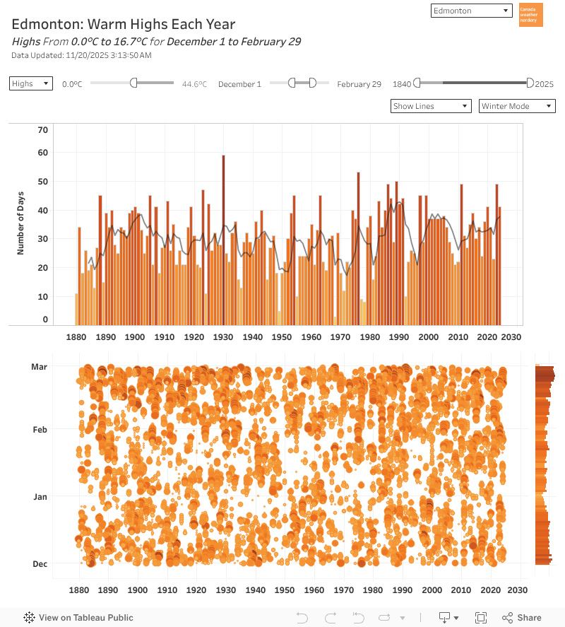 But Edmonton winters are not all deepfreezes.
Winter "heat"
In the deepest winter months of Dec-Feb we average around 35 above-freezing Highs (so around 40% of the winter days).
And that includes around 15 Highs which get to 5°C.
And those numbers haven't changed too much over the years.
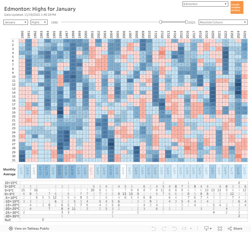 So even in January, our historically coldest month, we typically get around 2 weeks of above-freezing Highs, which includes a week around 5°C.
But January also often gets a week of deepfreeze too.
 And even a century ago January was a mix of mild days and (extremely deep) deepfreezes.
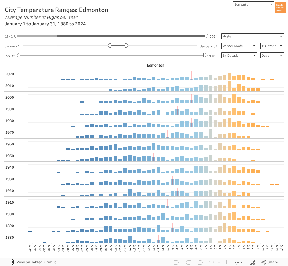 So if we don't get more warm days, but January has warmed by 8-10°C, how does that work?
It's all about the temperature distributions.
The top end hasn't moved too much, but a lot of the bottom end has disappeared.
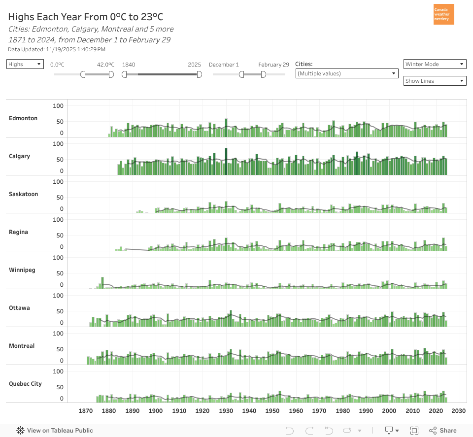 Of Canada's "winter' cities, Calgary's chinooks make it the undisputed champion of mild winter days, with 53 (58%) of Dec-Feb getting above-freezing.
Edmonton, Ottawa & Montréal are around 35.
Quebec City & Regina are around 20
Saskatoon & Winnipeg are around a dozen.
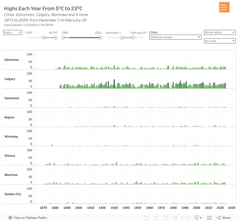 For 5°C winter Highs Calgary is close to 30 (33% of Dec-Feb).
Edmonton is around 15.
Ottawa & Montréal are around 8.
The rest are typically below 5.
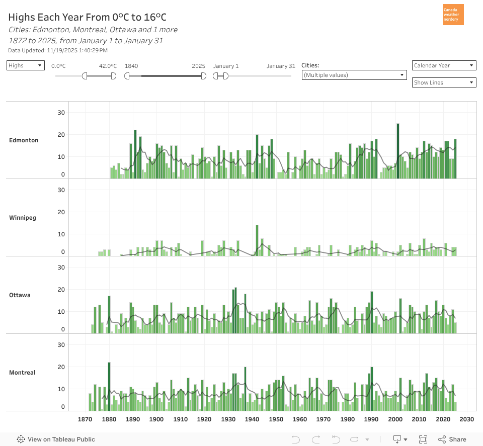 A problem with our temperature swings is it makes winter events tricky.
In the middle of January we can have 5°C Highs or -25°C Lows.
So for skating, icecarving, icecastles, crosscountry skiiing, fatbiking, flying canoes, etc, every few years the weather doesn't cooperate.
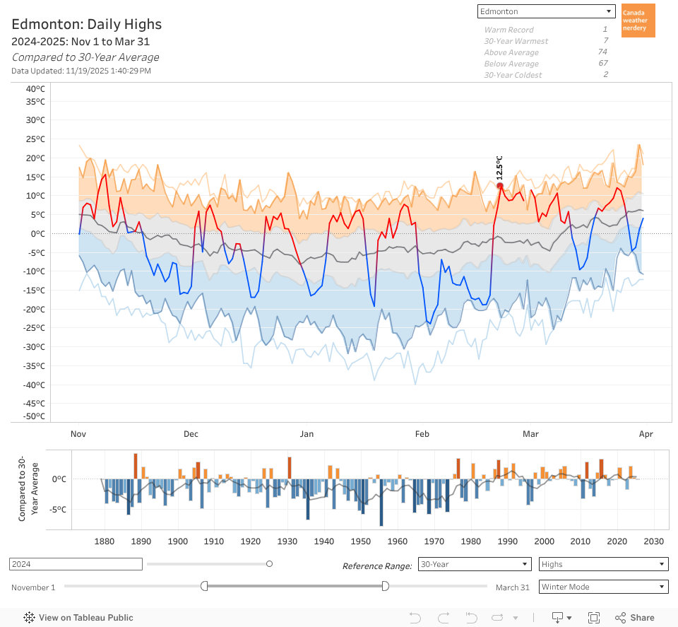 But bringing it all back to the beginning:
Our average High is below 0°C from November 19 through March 9th.
In that time we'll probably get 3~4 weeks of deepfreeze scattered around.
But we'll also get lots of mild days, with more than 40% of daily Highs above freezing.
And that brings us to the end of Part 1 of our look at Edmonton winters.
This has obviously been Edmonton-centric, but all of these dashboards are interactive, and have similar data for 17 Canadian cities.
Tomorrow we'll be back with Part 2, and a look at Snow.


