
(if you are reading this in the distant future some of the dashboards below may have updated to reflect new data or formatting, or they may be broken, or they may no longer make sense. To see the original images for this post refer to this twitter thread.)
High Temperatures

Overall 8 Highs were below average, and 21 were above.

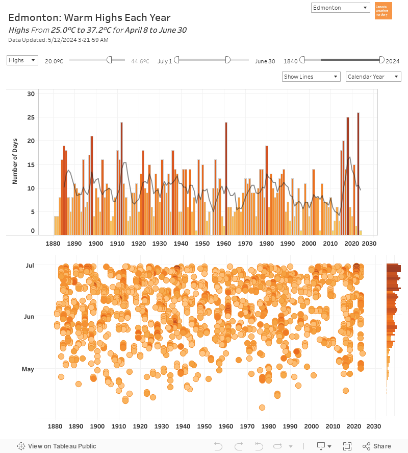
Hot Days So Far
 For hot days so far we have had 13 Highs hit 30°C. That is tied for 2nd with 2002 and 1933, and it just behind the record of 14 from 1961.
We have also had 12 Highs hit 31°C, which is a record. 2002 is in 2nd place with 9 31°C days, and then 1933 and 1936 both had 8.
Our peak 30°C season lasts until about August 18th (after that they become much less frequent), so we might see some more this summer.
Low Temperatures
 For Low temperatures July 2021 started with the heatwave, and set new warmest-record Lows on July 1st at 23.4°C (the warmest overnight Low ever recorded in Edmonton), as well as on July 2nd, 3rd, and then one more on July 15th.
Overall 25 Lows were above average, with 6 below.

Warm and Cold Months
 Overall July 2021's average High of 25.9°C ranks as Blatchford's 6th warmest July, while the average Low of 14.9°C is #2 warmest.
2007 was the warmest July on record, with an average High of 26.6°C and Low of 15.2°C.
July 2021 Across Canada
 Looking across Canada July 2021 was above average in the west, and below average in the east.
That ranged from Winnipeg Highs at 3.5°C above their July average, to Ottawa at 1.4°C below theirs.
Looking across Canada July 2021 was above average in the west, and below average in the east.
That ranged from Winnipeg Highs at 3.5°C above their July average, to Ottawa at 1.4°C below theirs.

June + July
 ...July was Edmonton's #6 warmest July, and June was #1 warmest June.
Together, they are our warmest June + July on record, by a pretty convincing margin.
2021's average High of 25.4°C beats 2002 at 24.7°C and 2015 at 24.6°C.
The average Low of 14°C beats 13.1°C from 2006 and 2007.
...July was Edmonton's #6 warmest July, and June was #1 warmest June.
Together, they are our warmest June + July on record, by a pretty convincing margin.
2021's average High of 25.4°C beats 2002 at 24.7°C and 2015 at 24.6°C.
The average Low of 14°C beats 13.1°C from 2006 and 2007.

Precipitation
 On average July is our rainiest month, with June as #2. Together June and July average 160mm of precipitation.
In 2021 Blatchford received 45.1mm, which is its #1 lowest since 1881.
The airport's 81mm was its #3 lowest since 1961.
And Stony Plain's 47.3mm is its #1 lowest since 1966.
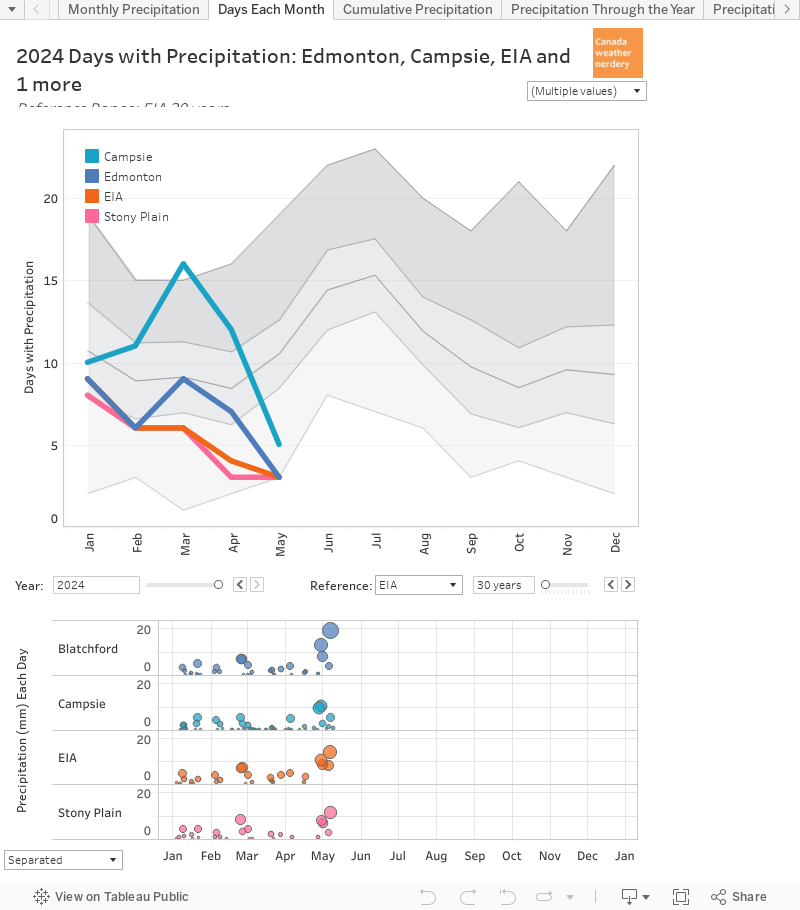

The Airport is the outlier with its 213mm. St. Albert and New Sarepta are both around 170mm, and then the rest are below 150mm.
Precipitation Across Canada
 This chart is a little messy again, but it has precipitation for cities across Canada.
The only city here with above-average precipitation in 2021 in St. John's, and that is just a bit above average.
Winnipeg is having its driest year on record, after a series of dry years.
August Temperatures

 Thinking ahead to August, on average we have 25 Highs which reach 20°C, including ~10 above 25°C. And about half of the time August hits 30°C.
Most Lows are in the 10-15°C range, but about half of the time August will have a night below 5°C.
And August is our 3rd rainiest month averaging 52mm of precipitation.
Thinking ahead to August, on average we have 25 Highs which reach 20°C, including ~10 above 25°C. And about half of the time August hits 30°C.
Most Lows are in the 10-15°C range, but about half of the time August will have a night below 5°C.
And August is our 3rd rainiest month averaging 52mm of precipitation.
No comments:
Post a Comment