(Our only snowfall measurement now is at the airport, which is quite a bit colder than the city. But we'll use it because it's what we've got.)
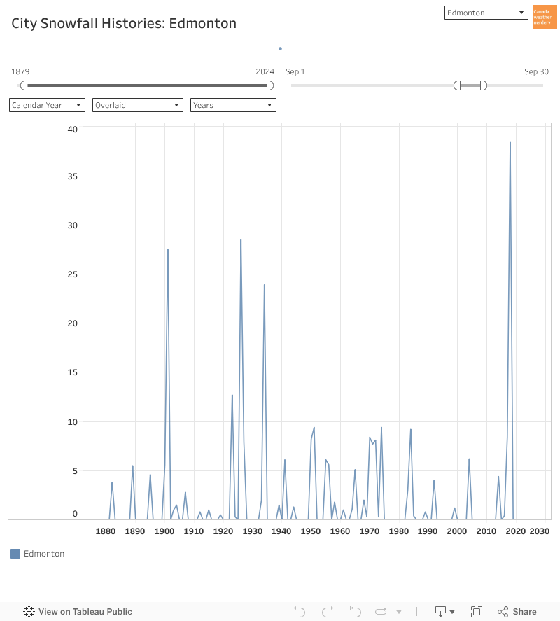
Snowfall History Edmonton averages 125cm of snow each winter.
Before the 1980s it was maybe a bit higher at around 135cm.
Edmonton averages 125cm of snow each winter.
Before the 1980s it was maybe a bit higher at around 135cm.
Snowfall History
Most winter months average around 20cm, while February & April are lower at 13cm.
October & May are pretty hit or miss, and average 6cm.
 Snow is also possible in June, August & September, but those are pretty uncommon.
The airport's last June snow was 1.4cm in 2011.
For August it was 0.1cm in 2016.
And September is a little snowier, with a record 38.4cm in 2018, and smaller snowfalls in 2014 & 2004.
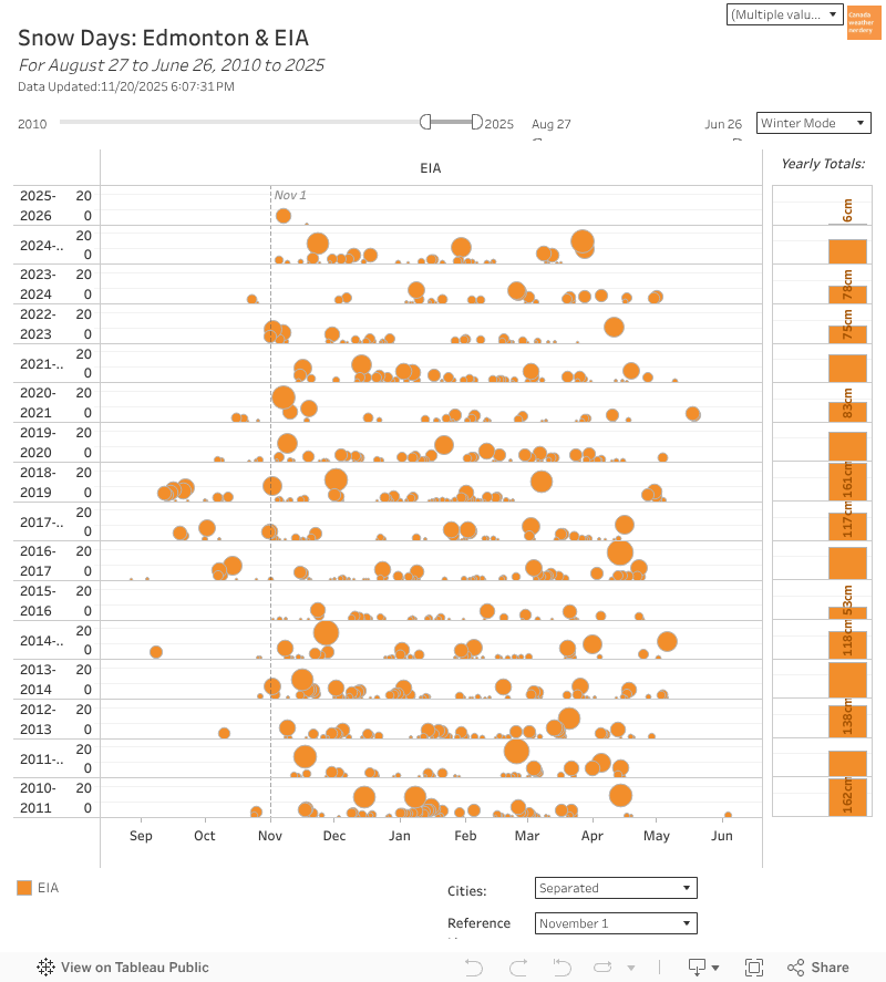
 In terms of snowy days, November-March average 8 or 9 of them, with January peaking at 10.
For April it's 5, and October is 4.
In terms of snowy days, November-March average 8 or 9 of them, with January peaking at 10.
For April it's 5, and October is 4.
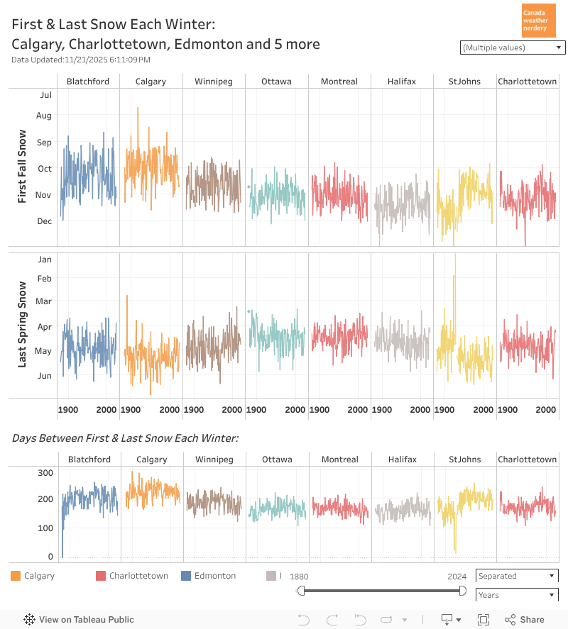
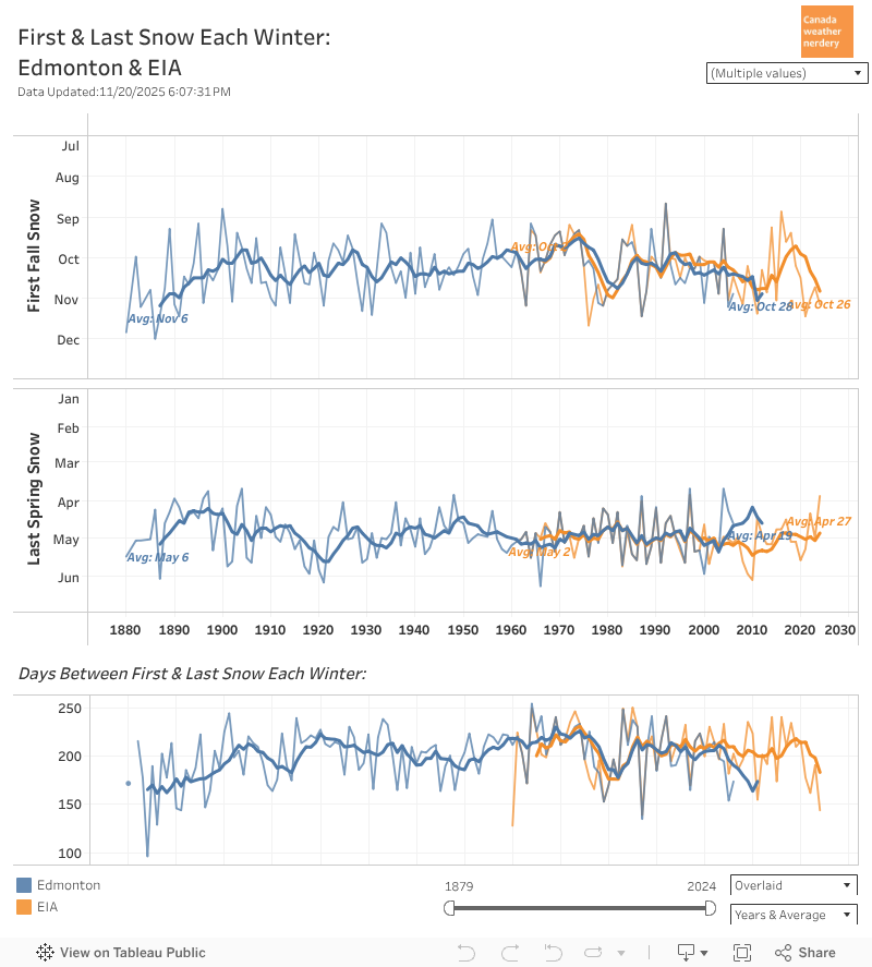 Historically our first fall snow has been around mid-October, although just the past few years are closer to the end of October.
The average final spring snowfall is around the end of April.
And so from the first snowfall of winter to the last we average right around 200 days.
 So we get snowfall pretty consistently for November through April. Although some winters will have an early start, or a late end, or both.
Around Canada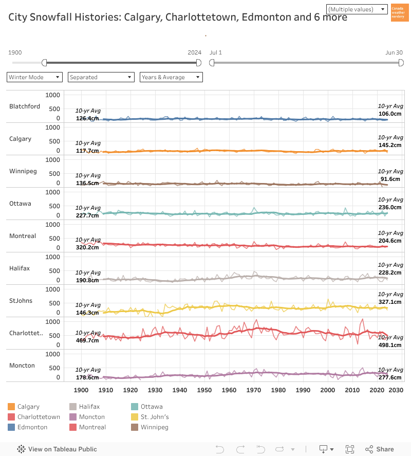 Of Canada's winter cities, Edmonton's 125cm of snow (or ~110cm recently) is actually near the bottom.
Around Canada
Winnipeg doesn't record anymore, but was also around 120cm. And Calgary is around 145cm.
But the east coast cities are all over 200cm, and Charlottetown is near 500cm.
 For most of these cities the snow totals have stayed pretty level over the years.
Montréal is the biggest exception, falling from 320cm down to 210cm.
(St. John's saw a big jump in 1940, possibly due to a station move? But it's been flat since then)
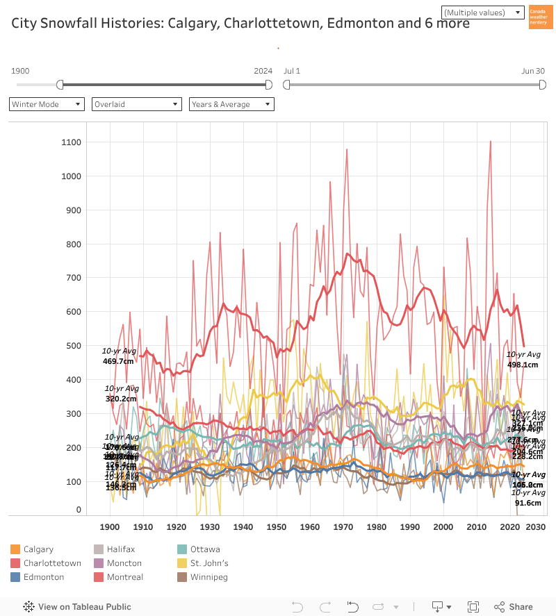
 So Edmonton gets less snow than other cities, but we get it over a longer period of time.
We might go 200 days between first and last snowfalls, and Calgary is closer to 220.
But in central Canada and the east coast 150 days is more typical.
 Compared to Edmonton, many of the other cities get a lot more snow over a much shorter period of time.
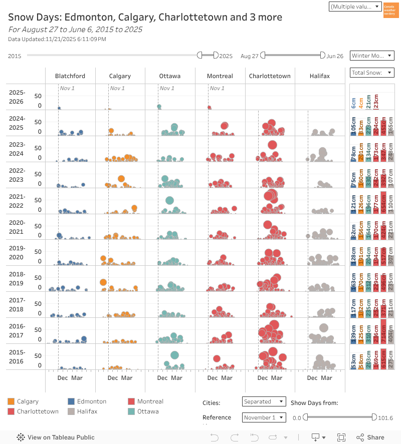
Big Storms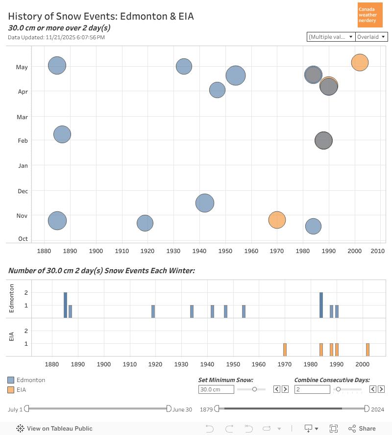 These bubbles are all of the 30cm+ storms (counting 2 consecutive days, to include snow that continues overnight).
Big Storms
There have only been 14 of them since 1880 at the two stations.
4 of those got to 40cm, with the largest on April 19-20 1955 with 46cm.
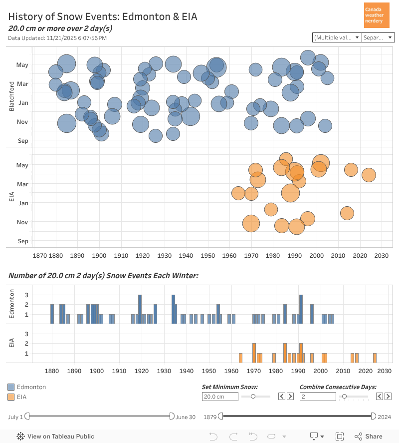 20cm 2-day storms only happen every few years, with the most recent March 27-28, 2025.
For 10cm storms we'll get 1 or 2 per winter.
And for 5cm storms it's 4~8.
Big Storms Across Canada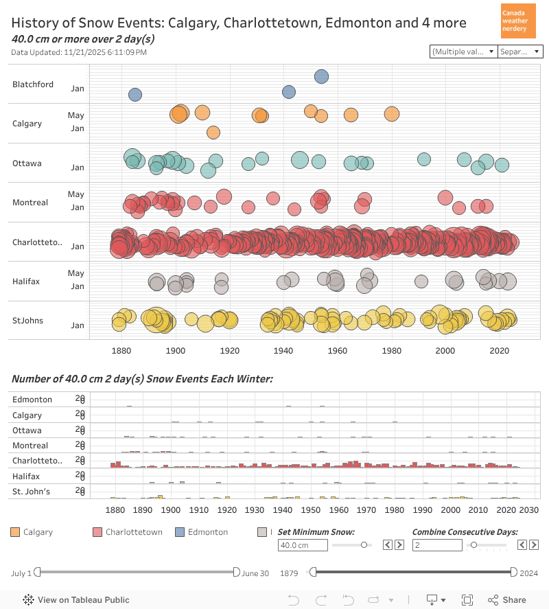 In 140+ years Edmonton has only had a handful of 40cm+ storms. Calgary has had a few more than that.
Ottawa & Montréal got a lot before 1900, but now they're pretty rare.
But Halifax still gets 1 in most winters, and Charlottetown gets a few every winter.
In 140+ years Edmonton has only had a handful of 40cm+ storms. Calgary has had a few more than that.
Ottawa & Montréal got a lot before 1900, but now they're pretty rare.
But Halifax still gets 1 in most winters, and Charlottetown gets a few every winter.
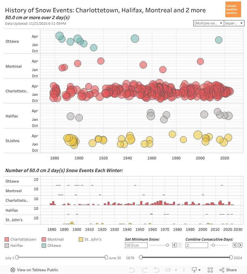 This is the 50cm+ 2-day storms for these cities.
Big Storms Across Canada
Charelottown's biggest on record was 153cm in 2004, and St. John's was close with 152cm.
Ottawa & Halifax are both around 75cm, and Montréal's was 58cm.
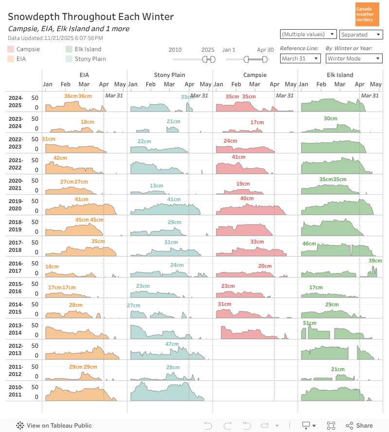
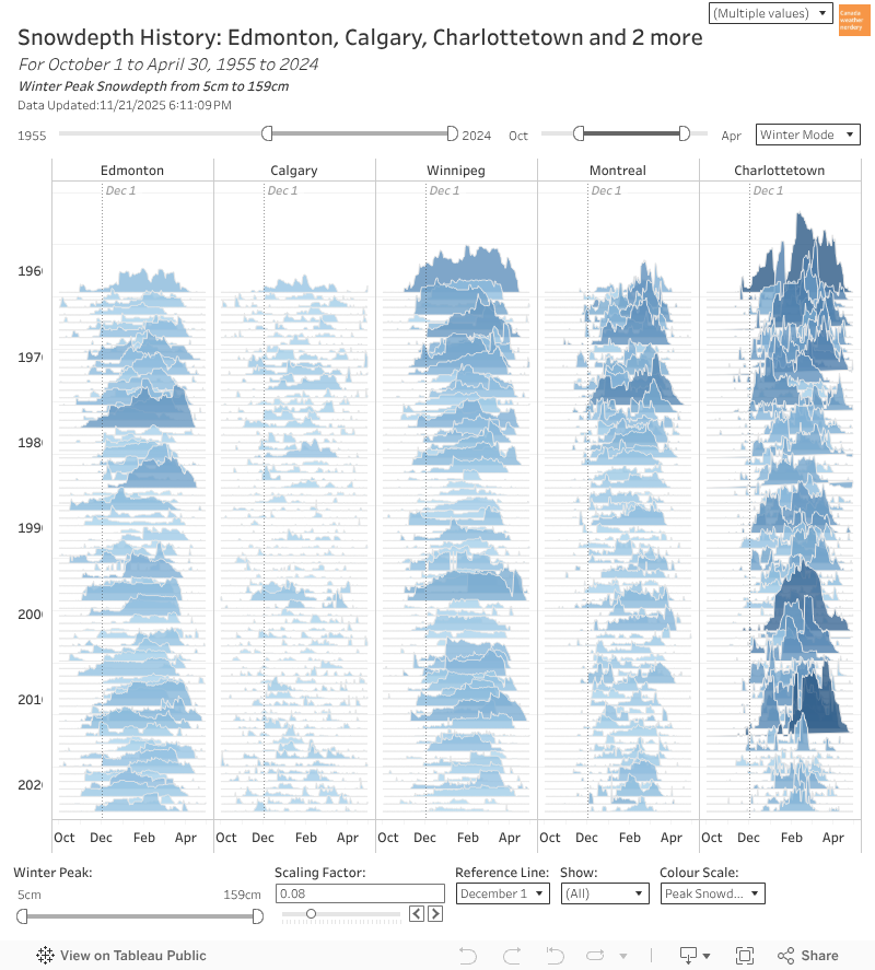
Snowdepth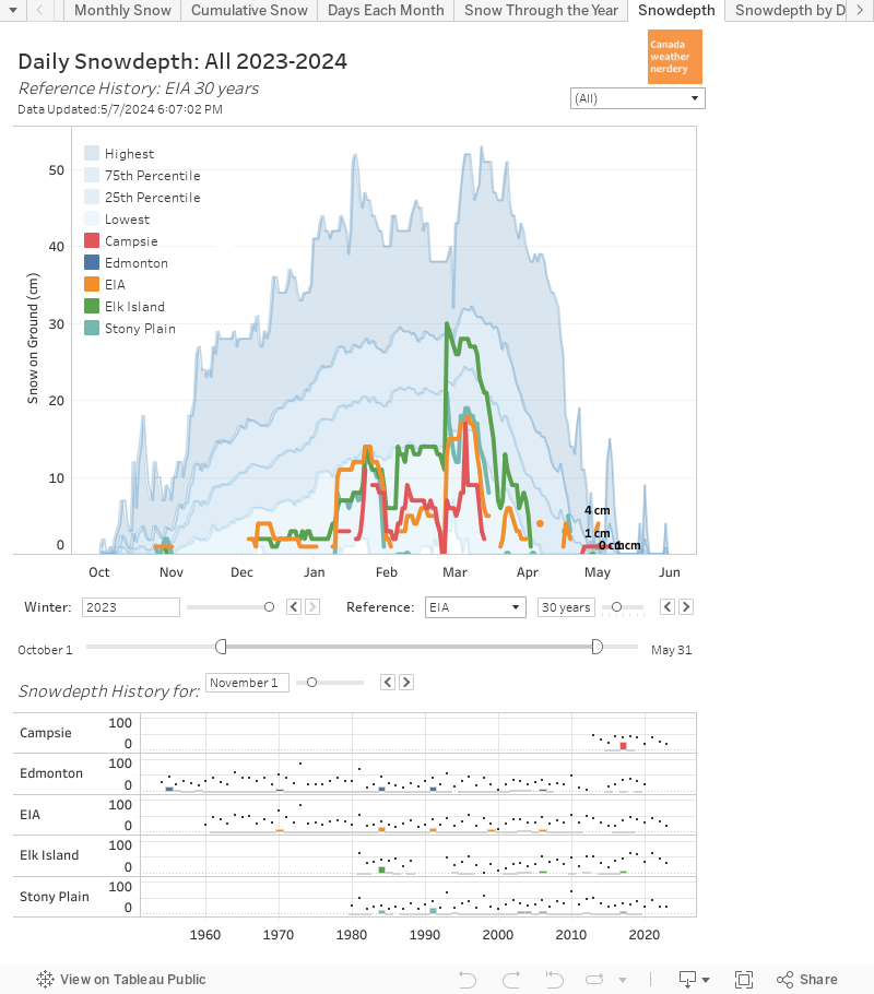 This shows the average and the range of our snowdepth throughout the winter.
Snowdepth
It starts to climb around November 1st, and levels off at the end of February around 24cm.
The big spring melt starts a week into March, and we (or at least the airport) are down to 0cm sometime in April.
 Every winter is a little different though.
When we do get early snow in Sep/Oct, it usually melts off.
But after November 1st any snow that we get usually hangs around until spring.
Every winter is a little different though.
When we do get early snow in Sep/Oct, it usually melts off.
But after November 1st any snow that we get usually hangs around until spring.
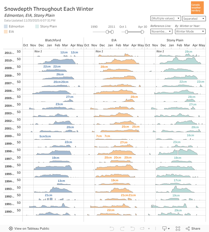 The outlying stations aren't a perfect proxy for the city, but they're not bad.
Back when Blatchford did measure snowdepth it's numbers were maybe a little bit lower than the airport's, but it's still pretty close.
The outlying stations aren't a perfect proxy for the city, but they're not bad.
Back when Blatchford did measure snowdepth it's numbers were maybe a little bit lower than the airport's, but it's still pretty close.
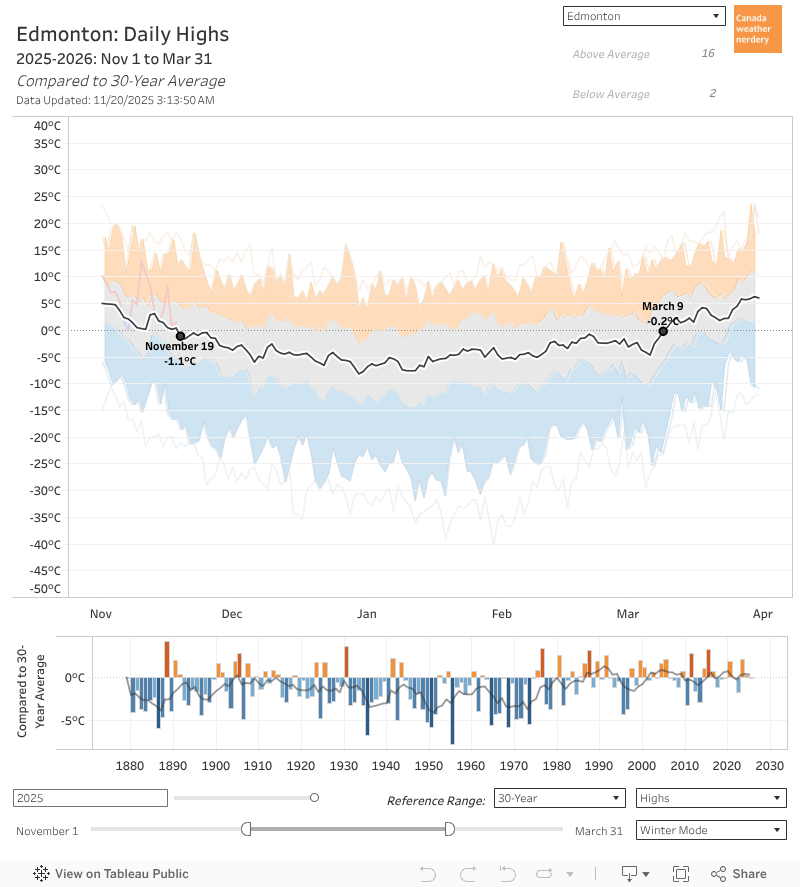
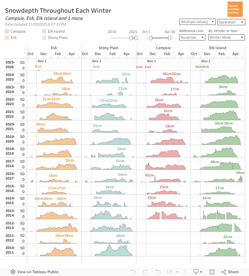
 So far the winter of 2025-2026 is off to a pretty slow start for lasting snow.
2024 waited until November 22nd, and 2023 was December 3rd.
But 2021, 2016, 2015, 2011 & 2010 also all waited until mid-November or later.
So far the winter of 2025-2026 is off to a pretty slow start for lasting snow.
2024 waited until November 22nd, and 2023 was December 3rd.
But 2021, 2016, 2015, 2011 & 2010 also all waited until mid-November or later.
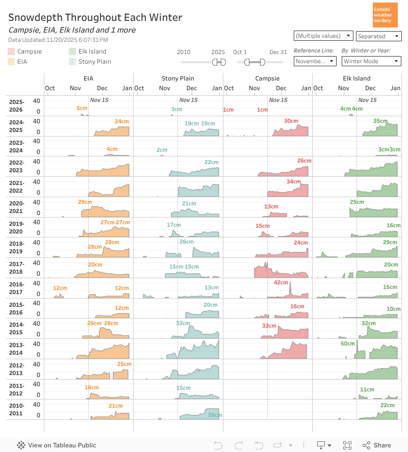
 For the big spring melt we're often basically down to 0cm of snowdepth by the end of March, although sometimes a late snowfall will bump it up again temporarily.
Some recent late years were 2021 on April 21st, 2018 on April 20th, 2013 on April 25, and 2011 on April 21st.
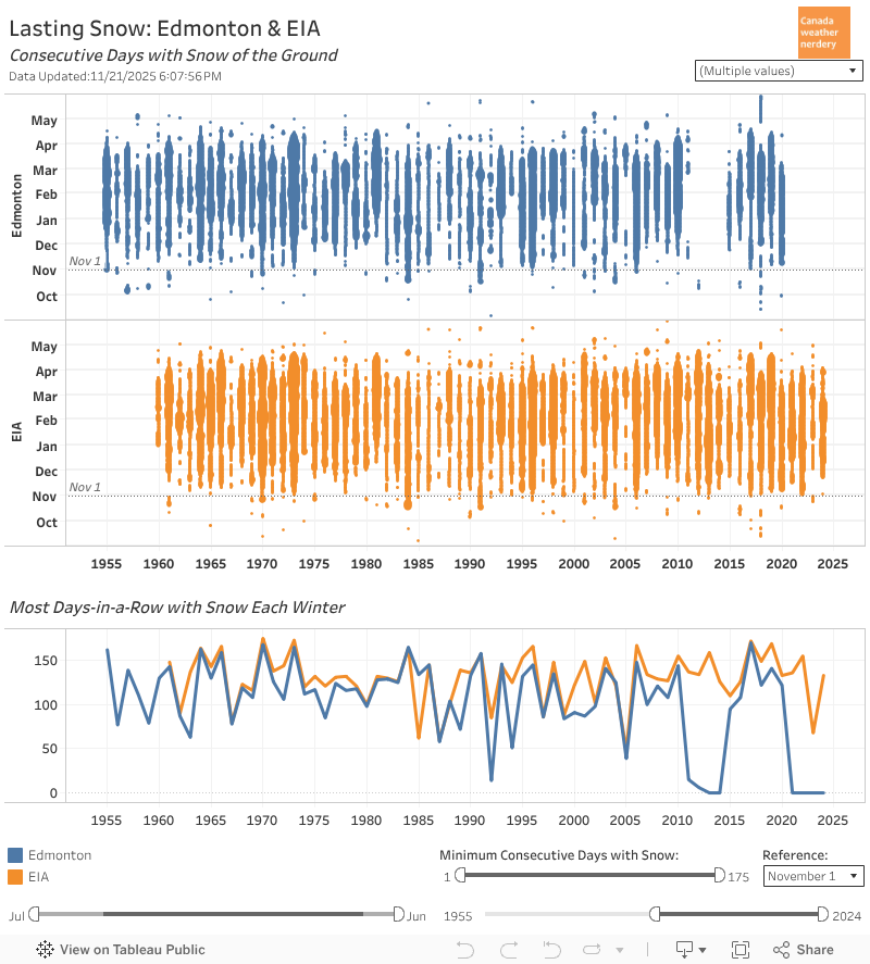 So we will usually have snow on the ground from mid-November to late-March, +/- two weeks on either end.
On average that's around 130 days in-a-row.
And that hasn't changed much since the 60s, and it wasn't too different between the city and the airport.
So we will usually have snow on the ground from mid-November to late-March, +/- two weeks on either end.
On average that's around 130 days in-a-row.
And that hasn't changed much since the 60s, and it wasn't too different between the city and the airport.
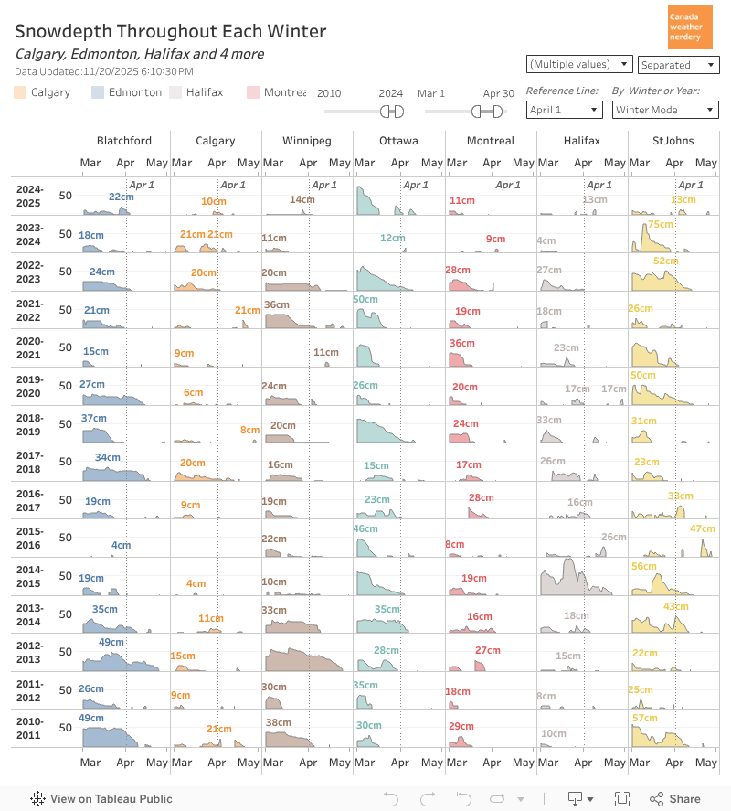
The Prairies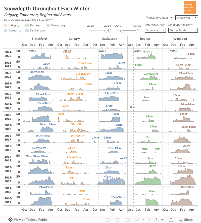 For comparison, Calgary is very different from us, with their frequent chinooks keeping the snowdepth low or zero for most of the winter.
The Prairies
Saskatoon, Regina & Winnipeg all tend to keep their snow, like Edmonton. But they also often start a few weeks after us.
Central Canada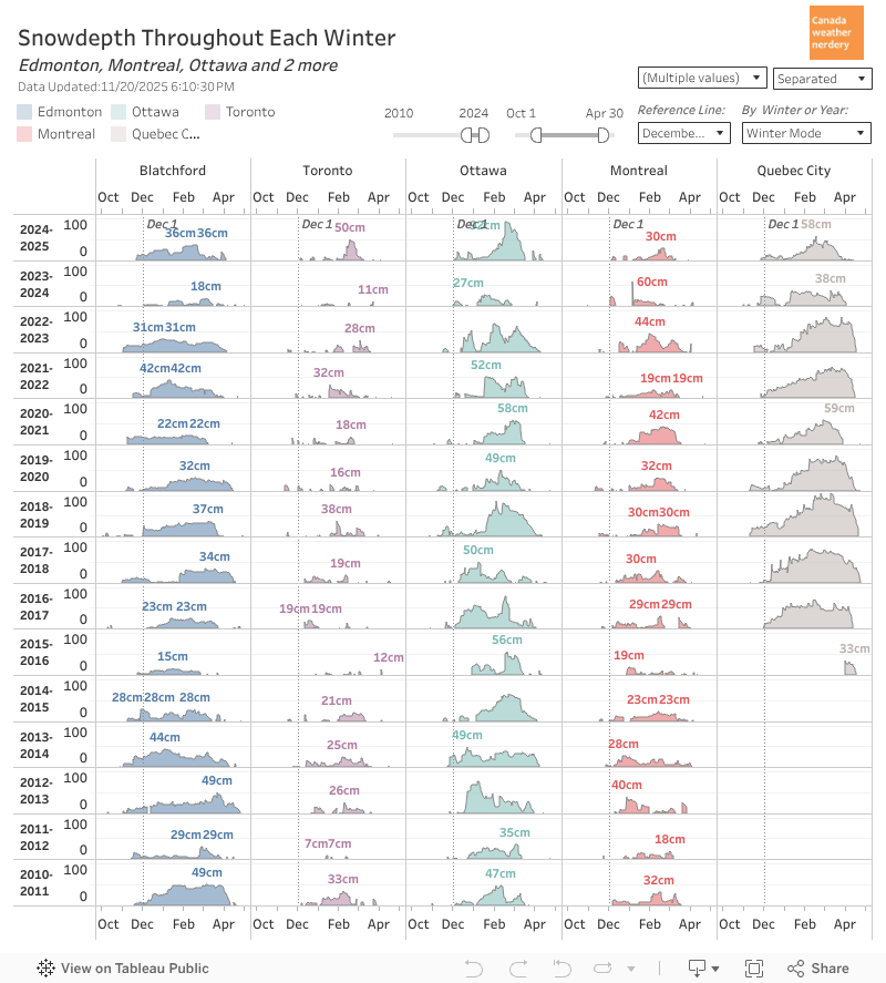 Snowdepth in central Canada usually starts closer to the beginning of December.
But where Edmonton usually peaks around 35cm, Ottawa & Quebec City will often get to 50cm, and sometimes up to 80cm or 90cm.
Snowdepth in central Canada usually starts closer to the beginning of December.
But where Edmonton usually peaks around 35cm, Ottawa & Quebec City will often get to 50cm, and sometimes up to 80cm or 90cm.
The East Coast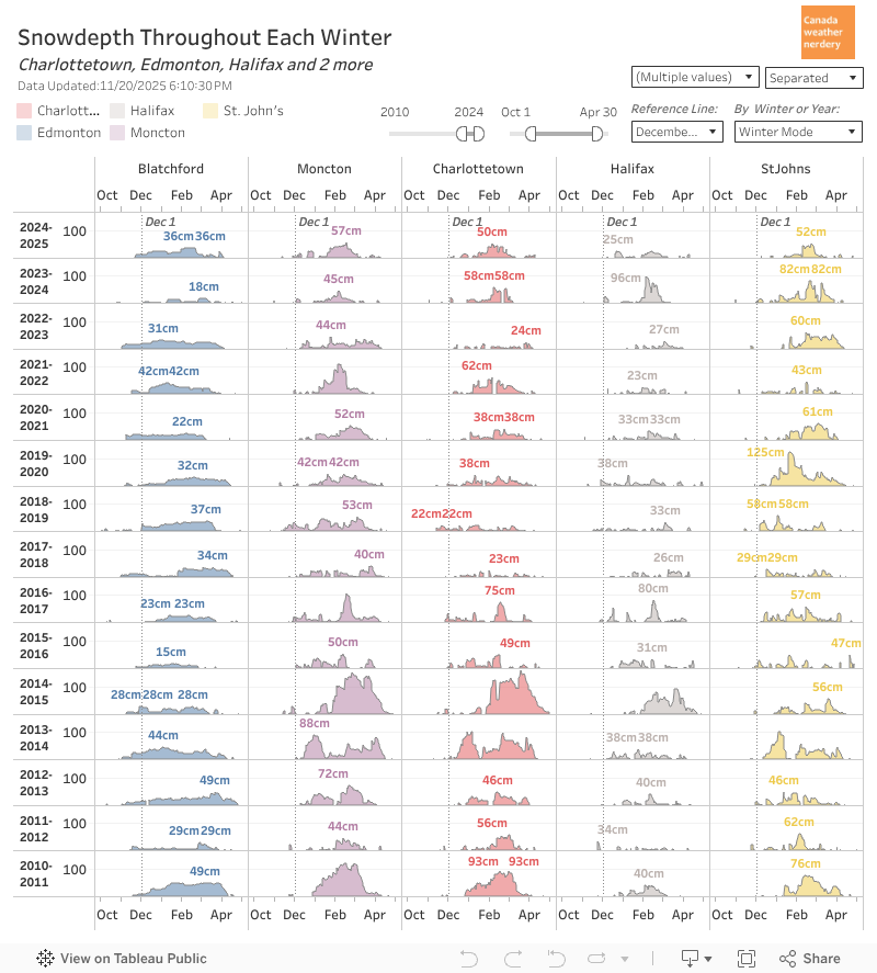 The east coast also gets started a month later than us, and gets melts throughout the winter.
A lot of these years peak around 50cm.
The east coast also gets started a month later than us, and gets melts throughout the winter.
A lot of these years peak around 50cm.
Central Canada
The East Coast
But St. John's got to 125cm in 2019-2020, and in 2014-2015 Moncton & Charlottetown both got above 150cm.
The Big Melt
Winter Rain
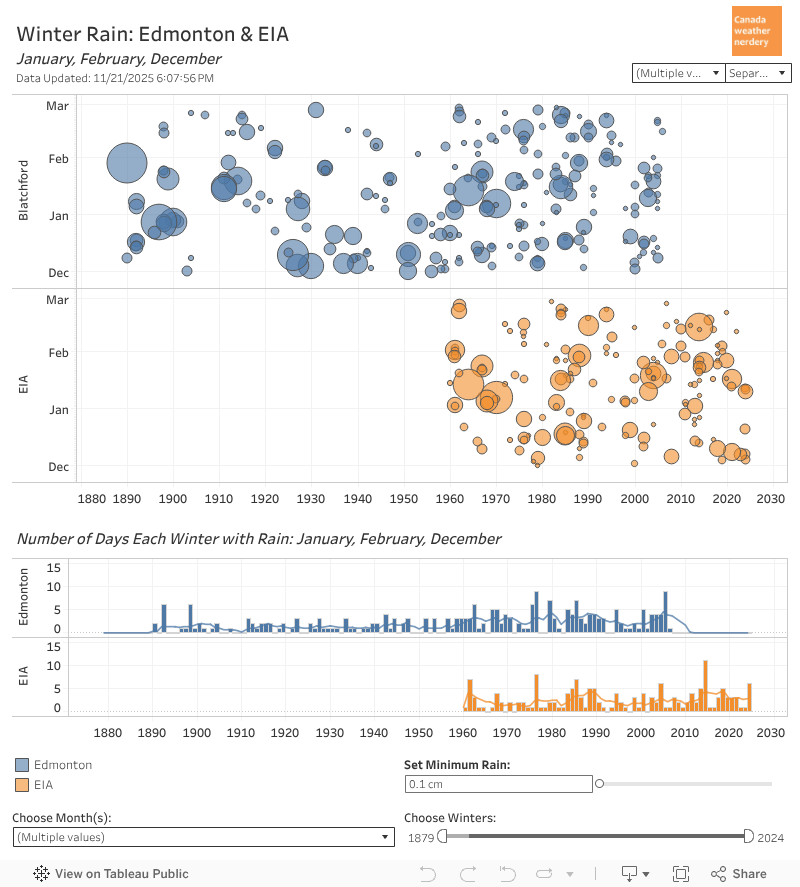
In December-February we average around 3 rainy days.
2024-2025 had 6 of them, and 2014-2015 had 11, while a lot of others only had 1 or 2.
And that brings us to the end of Part 2 of our look at Edmonton winters.