But 2025 was cold.
The average High of -8.8°C was our 108th warmest (out of 146).
The average Low of -18.4°C was 113th.
Lots of recent years were in the same range, like 2022, 2021, 2013, 2012, 2010, 2009, 2008...
High Temperatures December 2025 ended up with 9 Highs which were above our 30 year average, at the start, the end, an 1 in the middle.
High Temperatures
Our average High is around -4°C, but we spent a bunch of the month down around -15°C.
None got super cold, but there were a lot of them.
 December averages around 10 Highs above-freezing, and 2025 got to 7. The warmest was 8.5°C on the 15th.
And it averages 5 Highs below -15°C, and we had 11.
We didn't officially get any -20°C Highs, although the 11th & 12th both got to -19.8°C.
Low Temperatures For the Lows, 8 were above average, with the rest below.
Low Temperatures
Our average Low at this time of year is around -13°C, and we spent a chunk of the month below -20°C.
The coldest was -29.5°C on the 28th.
 December averages around 6 -20°C Lows, and 2025 had 13.
Recently 2022 had 12, and 2021 had 14.
December averages around 6 -20°C Lows, and 2025 had 13.
Recently 2022 had 12, and 2021 had 14.
December averages 2 -25°C Lows, and 2025 had 6.
The coldest was -29.5°C, but 2022 & 2021 both had 3 -30°C Lows, including a -35°C on December 28th, 2021.
 In comparison to 2022 & 2021, 2025 didn't have the extreme deepfreezes that the other two got.
Cold Days So Far On average we get around 25 -20°C Lows in a whole winter.
Cold Days So Far
December's 13 has gotten us more than halfway there by itself.
And for a whole winter we average around a dozen -25°C, and December gave us 6.
Cold Days In-A-Row December 2025's coldsnap was annoying, but not very interesting.
Cold Days In-A-Row
For -20°C Lows in-a-row we had 7. But a bunch of recent winters threw more than 2 weeks at us.
We had 13 -17°C Lows in-a-row, but we've gotten to 19 or 20 a few times recently.
 For cold Highs, we had 7 in-a-row below -15°C. That's a lot, but around 2020 we had a bunch of 11 day streaks.
And we've had 11 Highs in-a-row below -12°C, which is unusual, but 2019 got to 18.
1/3 Done Our average temperatures for December, January & February are all pretty close.
We've just had a cold December. There's nothing to stop us getting another deepfreeze in January or February.
But at this point we are about a third of the way through.
Our average temperatures for December, January & February are all pretty close.
We've just had a cold December. There's nothing to stop us getting another deepfreeze in January or February.
But at this point we are about a third of the way through.
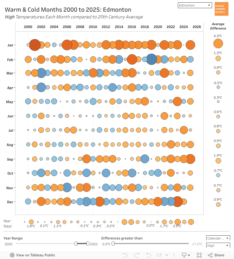
Warm & Cold Months December joins February as the two months of 2025 which were colder than our 20th century average.
1/3 Done
Warm & Cold Months
The average High of -8.8°C was -3°C colder.
The average Low of -18.4°C was -3.7°C colder.
But lots of Decembers (2022, 2021, 2015, 2012...) get blue bubbles here.
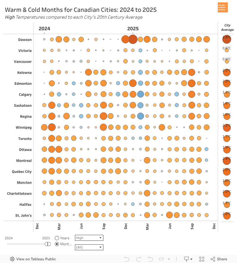
Across Canada December was cool across the country, although Dawson City (with an average high of -32.2°C and Low of -38.3°C), Edmonton, and Saskatoon got the worst of it.
Across Canada
Somehow Calgary escaped with a relatively mild month, even though the rest of the prairies were well below average.
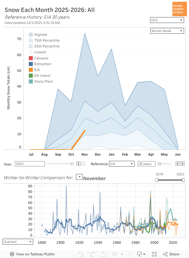
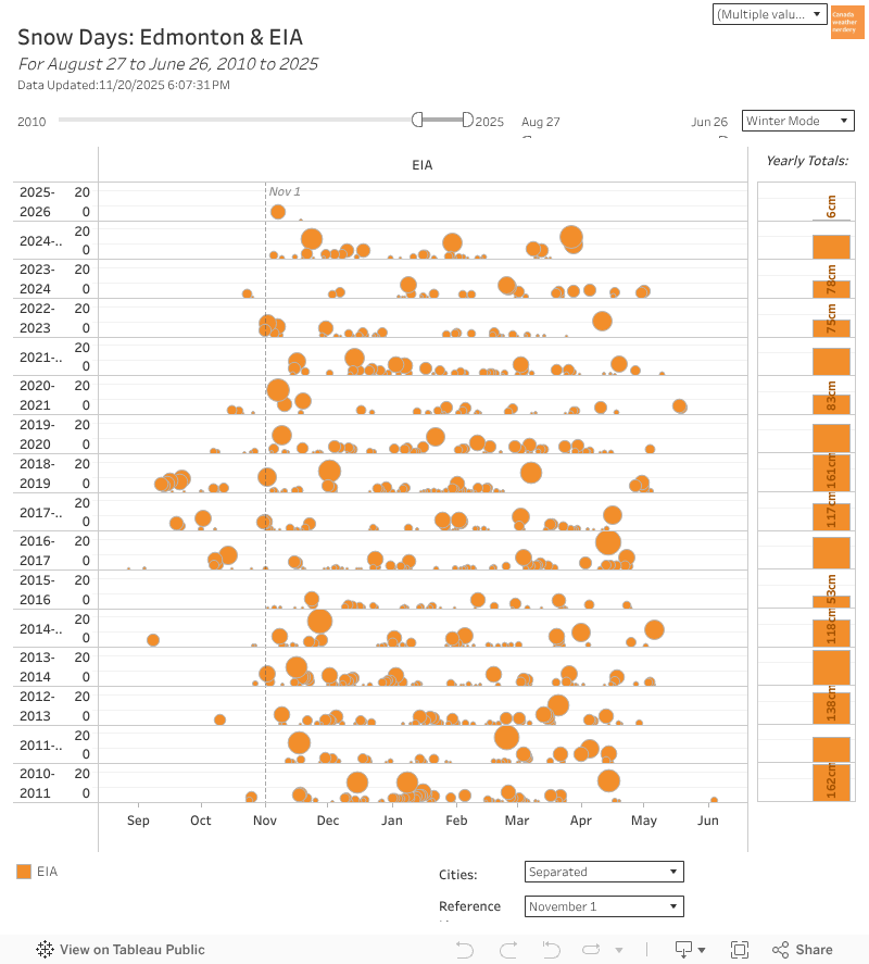
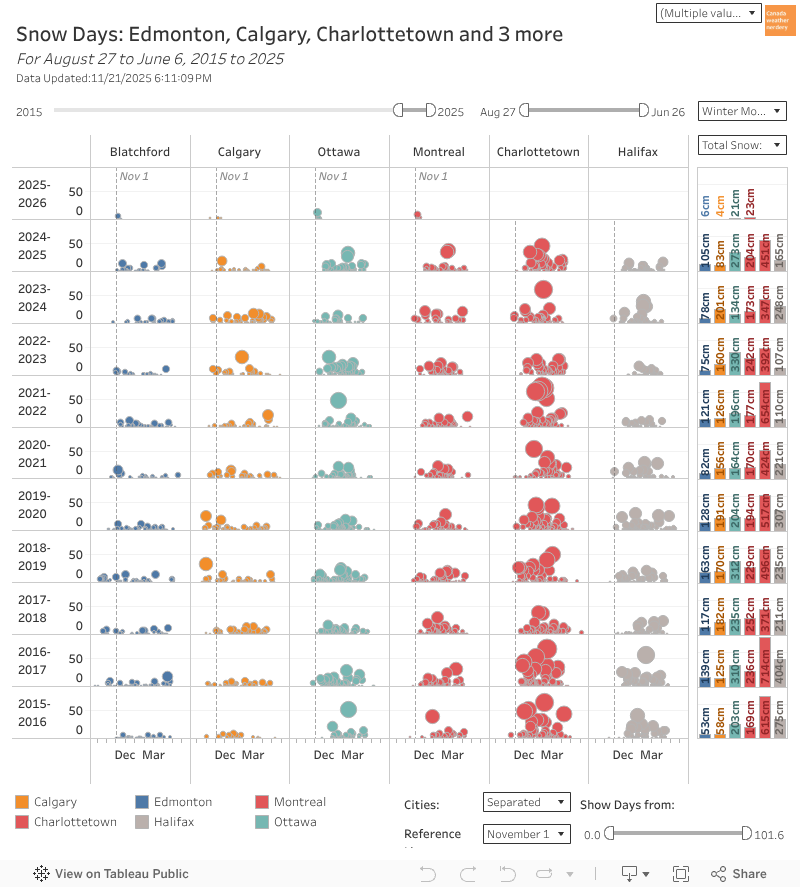
Snow In December we average 18cm of snow, and in 2025 we got 59.9cm.
Snow
That is actually a record for the airport, although if you go further back Blatchford's biggest December was 81.5cm in 1893.
 December's 59.9cm is the snowiest month that we've had since January 2011, which got 63.7cm.
And before that we have to go back to November 1996, which got 68.5cm at Blatchford & 73.7cm at that airport.
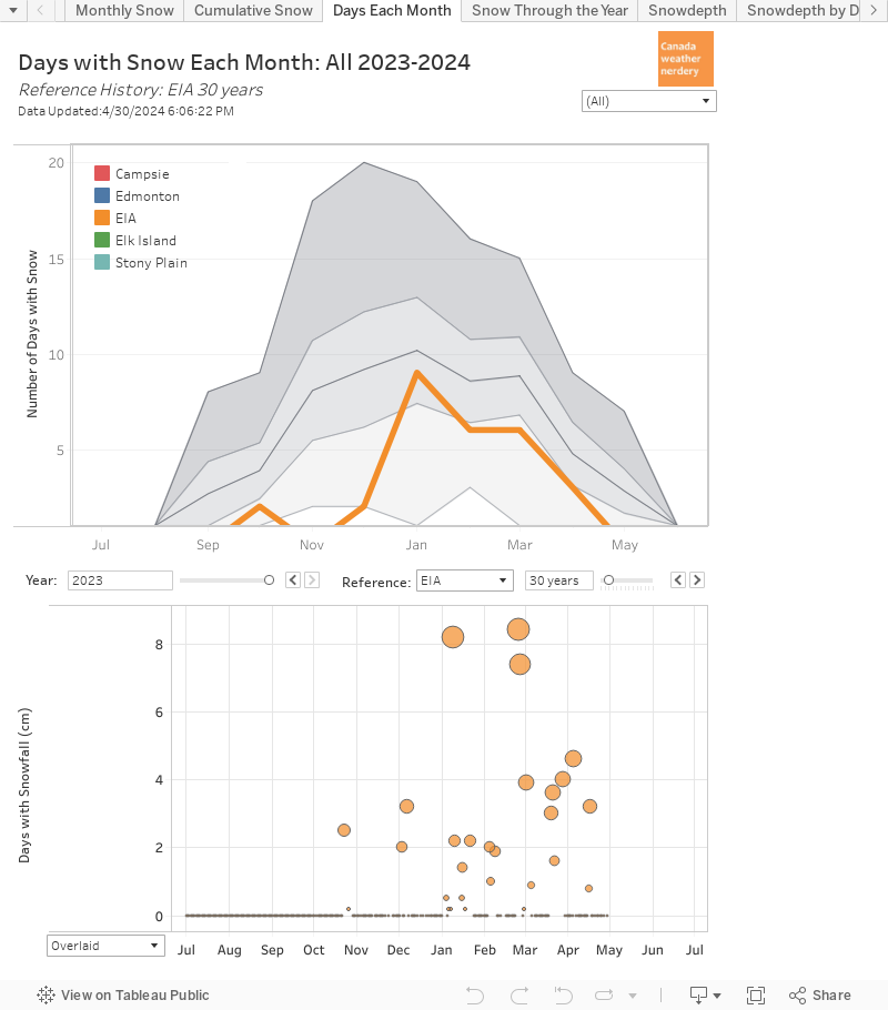 In December we average 9 days with snowfall, and 2025 had 12.
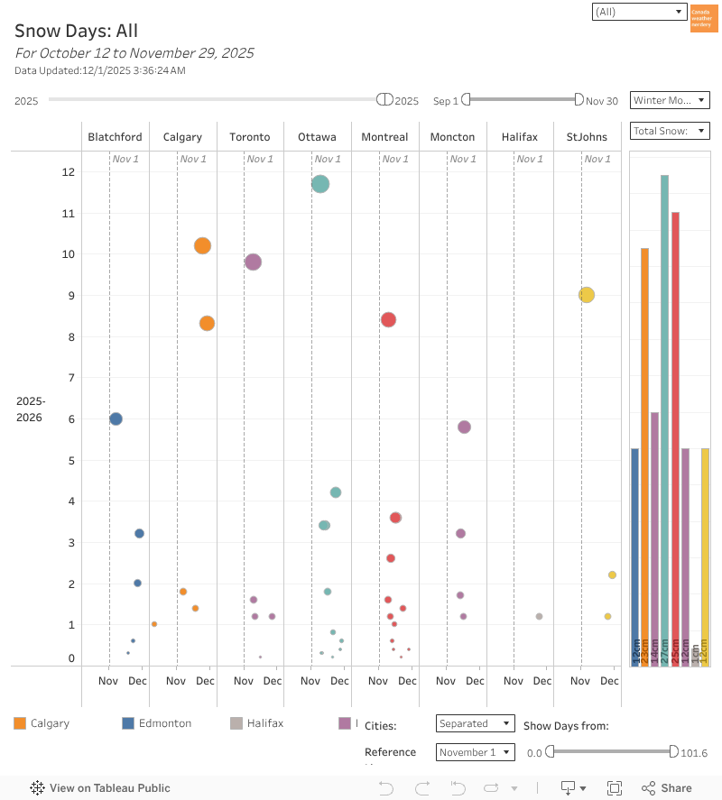
 The end of the month got a lot of big snowfalls.
The included 3 10cm+ storms, when we might get 3 in an entire winter.
The biggest was 18.3cm on the 16th & 17th.
The end of the month got a lot of big snowfalls.
The included 3 10cm+ storms, when we might get 3 in an entire winter.
The biggest was 18.3cm on the 16th & 17th.
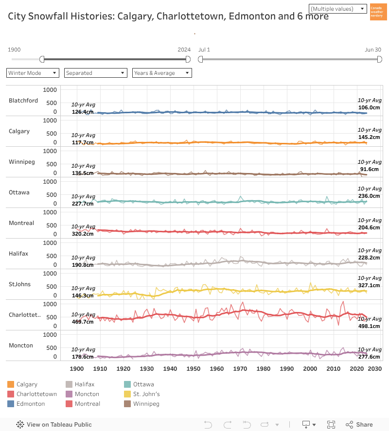
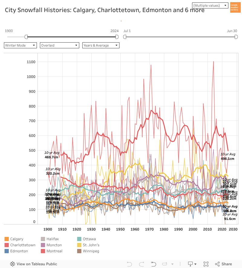
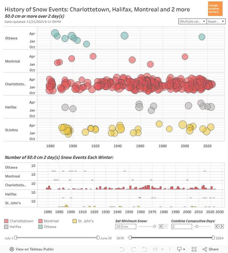
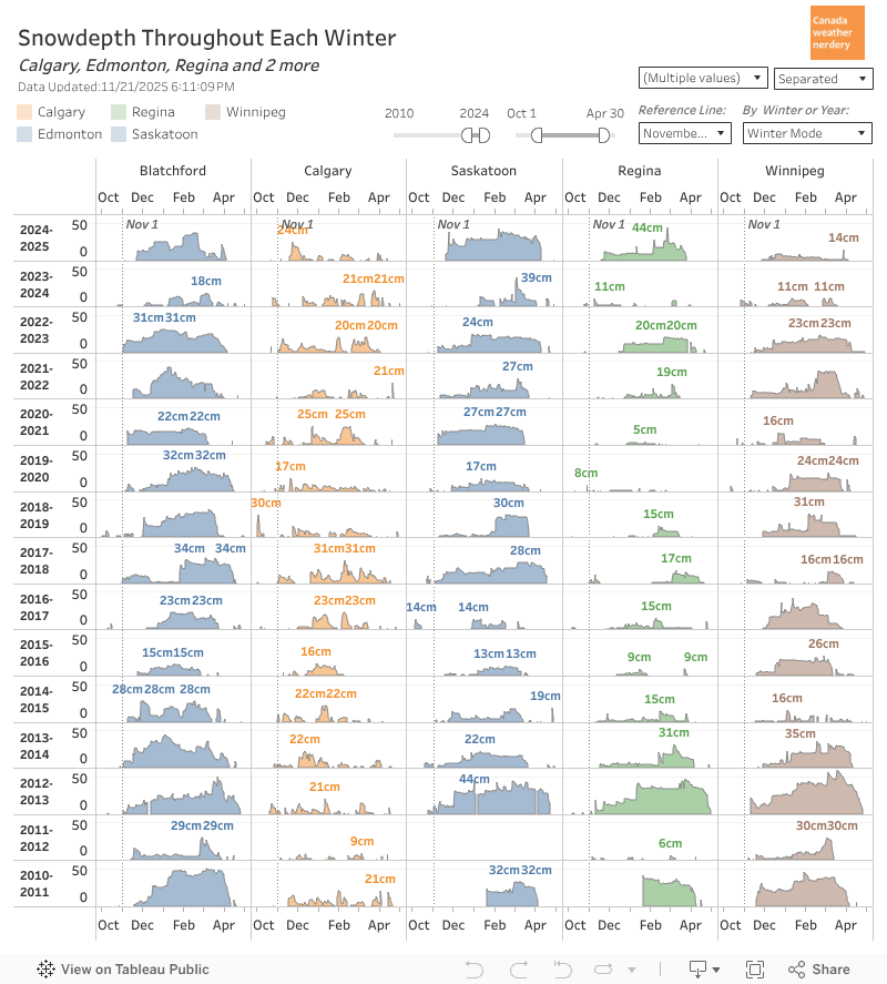
Snow Across Canada These are the snow totals across the country so far.
Snow Across Canada
Edmonton's 72cm is a fair amount for us.
But Ottawa, Montréal & Charlottetown are around 80cm, and St. John's is up at 107cm.
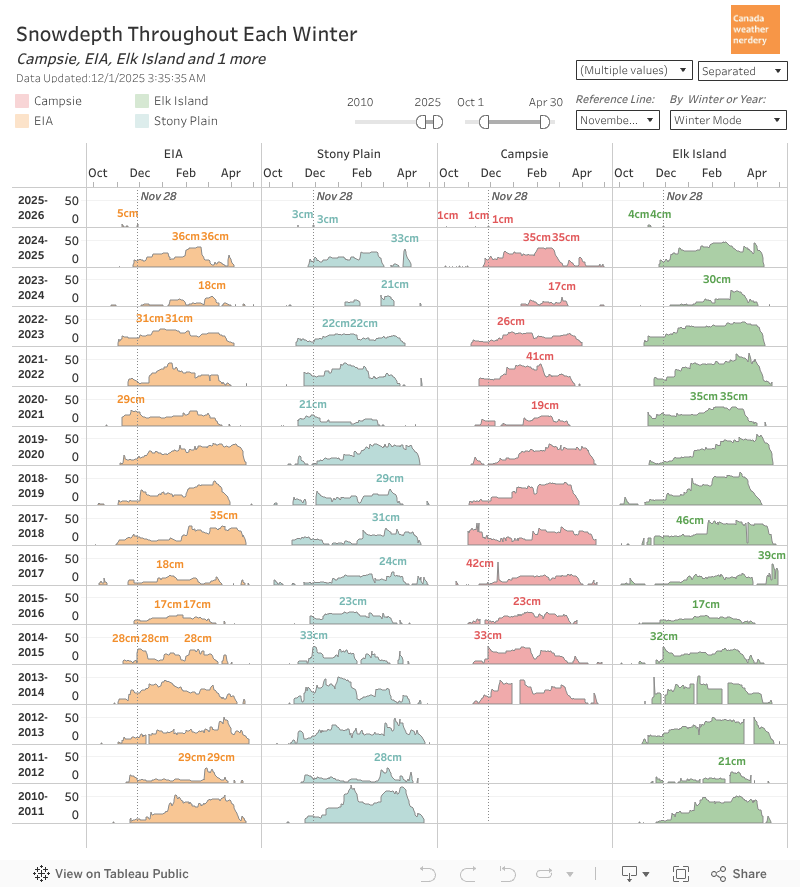
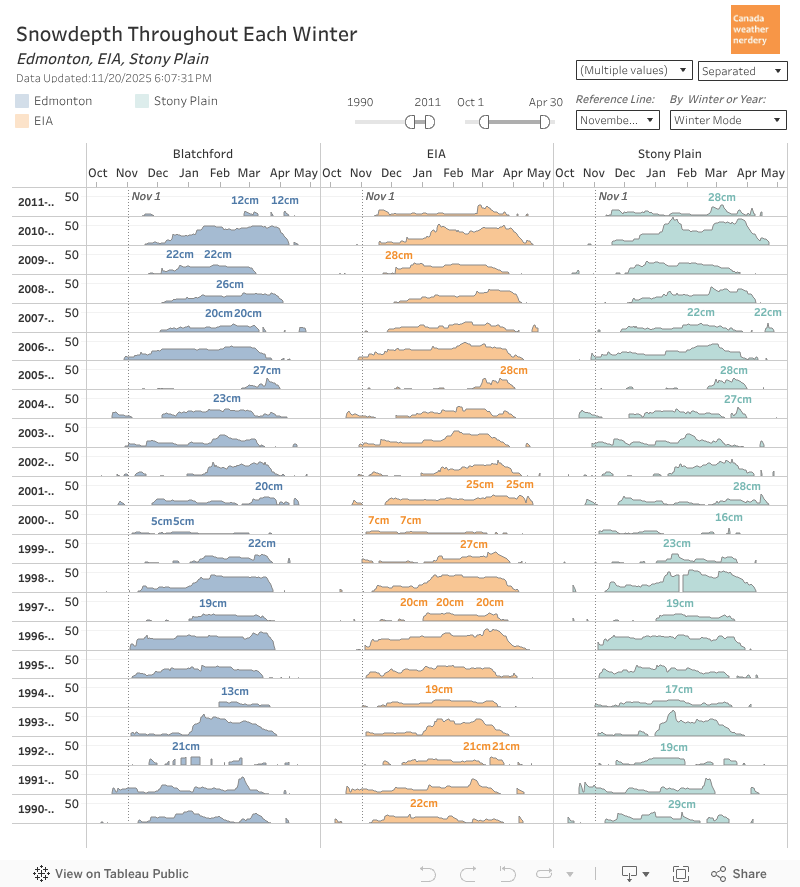
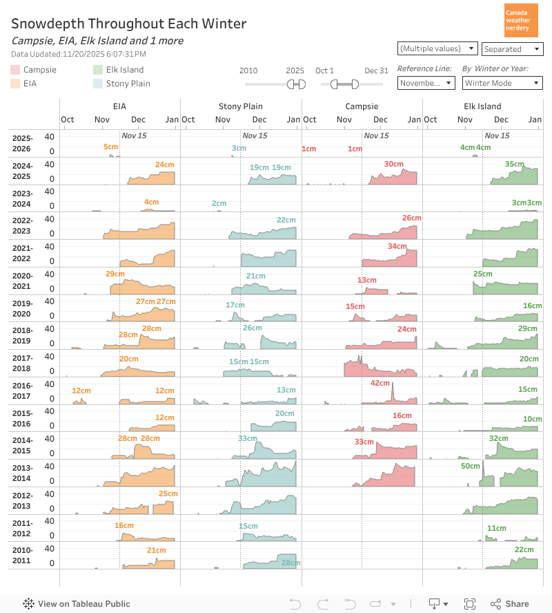
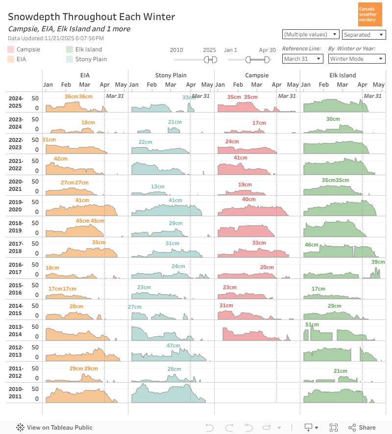
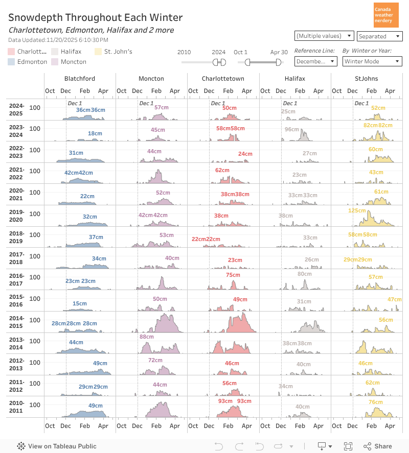
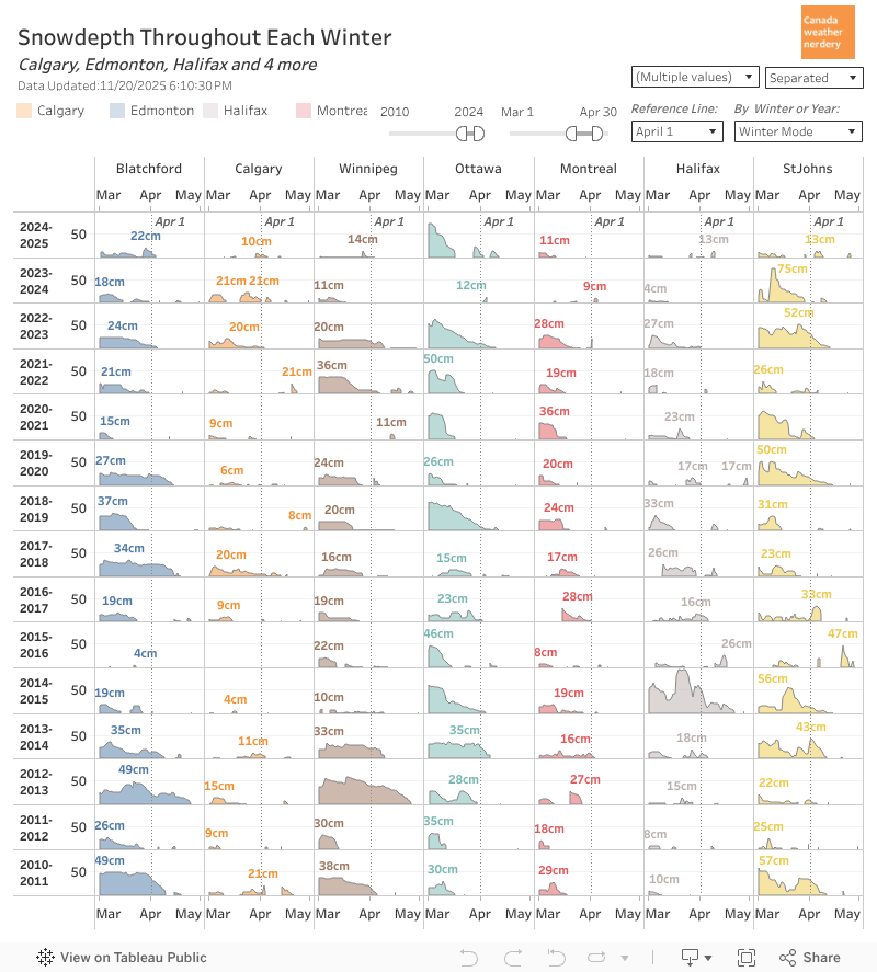
Snowdepth At this point of the winter we average around 15cm of snowdepth.
Snowdepth
But with December's record snow it's no surprise that the local stations are all well above that.
The airport is the lowest at 22cm, while Blatchford is at 46cm, after jumping up to 54cm.
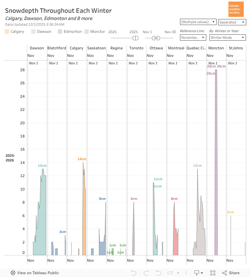
 These are messy charts, but around the country Edmonton's 46cm is well ahead of the other cities.
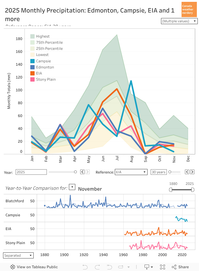
Precipitation In December we average 20mm of precipitation (rain+snow).
Precipitation
Given all of the snow it's no surprise that 2025 is above average.
Blatchford, Campsie and the Airport are all around 50mm, while Stony Plain was a bit lower with 38mm.
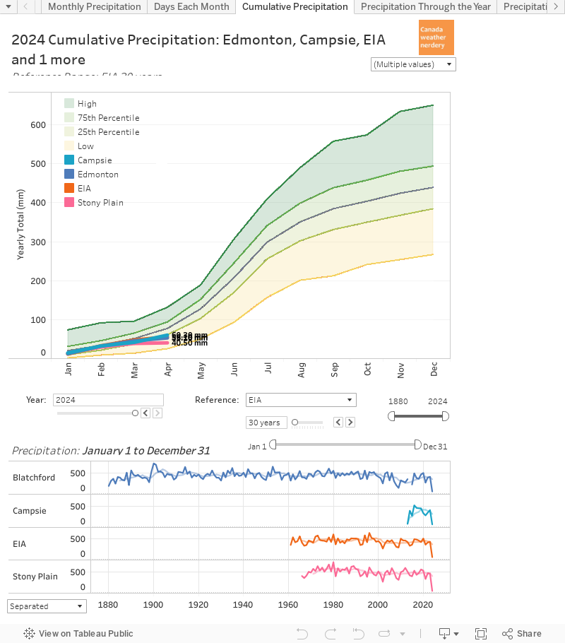 By the end of December we average around 430mm of precipitation for the year. But 2025 had a really low September, July, April & February.
The airport and Campsie did both end up right on the average.
But Stony Plain and Blatchford are 100mm lower, around 335mm.
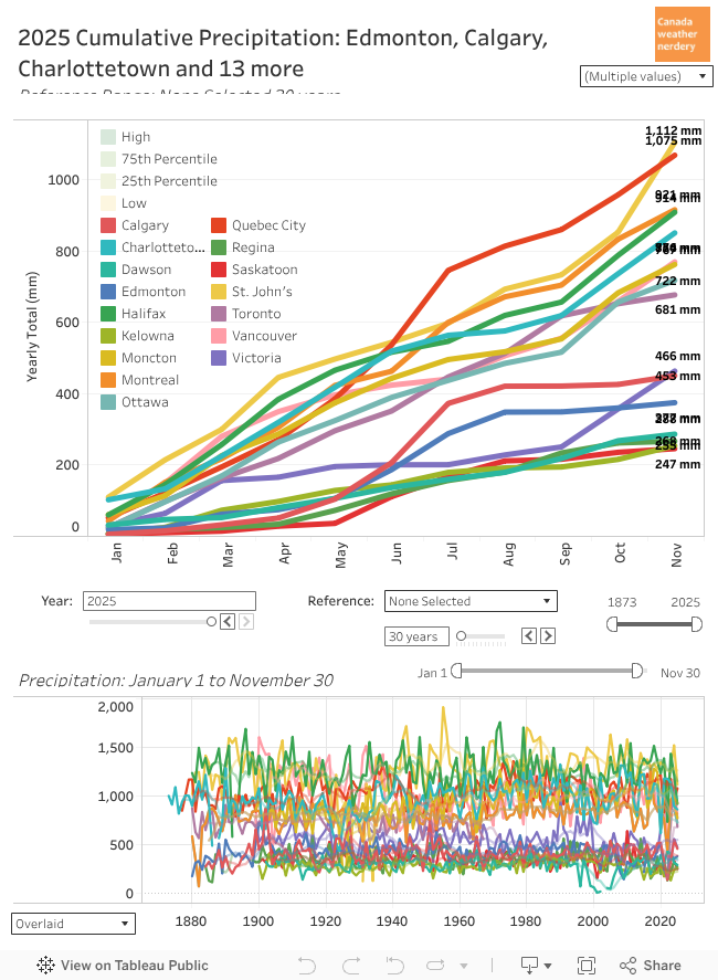
Precipitation Across Canada These are the precipitation totals for 2025 across the country.
Precipitation Across Canada
St. John's is way out ahead around 1,300mm, while Quebec City and Halifax both crossed 1000mm.
On the other end, the prairies are all below 500mm.
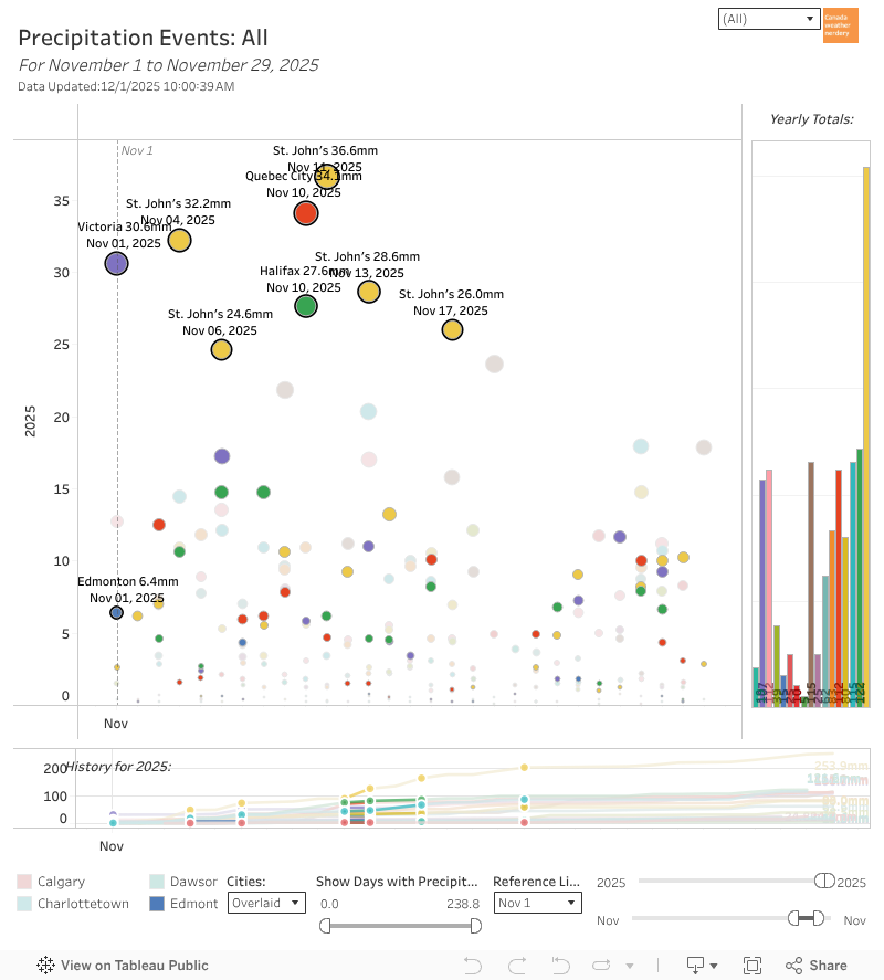
 For big December storms it was really Victoria's month, with 227mm, including 47mm on the 16th and 60mm on the 10th.
Toronto got 41mm on the 28th.
Vancouver's atmospheric river dropped 173mm, including 30.9mm on the 10th.
For Edmonton the biggest was 13mm on the 17th.
January As for January, on-average we get 12 days with Highs above freezing, with a week of those close to 5°C.
January
But January is also our biggest month for deepfreezes, with an average of 8 Lows of -20°C.
January's average snowfall is 22cm.